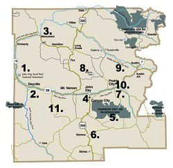
11 GREAT THINGS TO DO IN GRANT COUNTY
Published 5:00 pm Wednesday, April 30, 2008
- 11 GREAT THINGS TO DO IN GRANT COUNTY
From hiking in pristine wilderness, strolling through history in our museums or driving along scenic byways, these excursions are a great way to spend a day in Grant County.
1. John Day Fossil Beds National Monument, Sheep Rock UnitThe John Day Fossil Beds National Monument, about 40 miles west of John Day, near Kimberly, stretches through 14,000 acres that contain the richest cache of fossils in the world. The Thomas Condon Visitor Center and the Cant Ranch House, located in the Sheep Rock Unit two miles north of Picture Gorge and Highway 26, can easily take a day to fully explore the historical perspective of the region. Inside the center is a walk-through museum that holds exhibits, text panels and colorful murals that help visitors comprehend the detailed series of rock strata where the fossils are found.
The museum gallery has more than 500 specimens on display, surrounded by rock work, with backdrops of eight murals and more than 50 sounds – all to help transport the visitor back millions of years to the Age of Mammals, viewing a myriad of fossils and life-size models of prehistoric creatures and plants.
Add a hike along the various trails scattered through the Sheep Rock Unit and you can spend a couple of fine days in this corner of Grant County. Info: 987-2333.
2. South Fork John Day RiverThis scenic drive starts at Dayville, about 30 miles west of John Day on Highway 26. Follow the signs leading to the South Fork and Izee. The South Fork of the John Day River is one of the most scenic areas in Grant County, and one seldom explored. The road is not paved south of Dayville, so be prepared to take an hour or so traversing the 30 miles to Izee. This is actually a blessing, because you are better able to appreciate the beauty of the river and the canyon.
When you get to Izee, turn east and drive into the mountains on Grant County Road 63. This is very much a ranching region, and quite picturesque. Once you reach Highway 395, take time to visit Seneca, seven miles to the south, then return north to John Day on Hwy. 395.
3. Monument LoopThe Monument Loop takes you over scenic mountain passes and down picturesque valleys, all in one afternoon. Start at Mt. Vernon and drive north on US Highway 395 along Beech Creek. There are several trails that begin along the road, so don’t be afraid to stop and explore the mountains.
You’ll pass through the towns of Fox, Long Creek, Monument, Kimberly and Dayville. Each offers a peek into the past of the county, and a chance to slow down and enjoy the charms of life in small-town America.
Take time to stop at the Thomas Orchards, two miles north of Kimberly, and pick some fresh fruit for your trip. If you don’t feel like climbing a ladder to pick your own, they also offer fresh fruit already picked.
The route is US 395 to Long Creek, 402 to Kimberly, 19 to Picture Gorge, 26 to John Day.
4. Historical Museum TourYou can find a great deal of Grant County history preserved in the museums in this tour. Each emphasizes one aspect of life in rural Eastern Oregon.
The Kam Wah Chung & Co. Museum on NW Canton Street,in John Day, operated by Oregon State Parks, is still much like it was the day Doc Hay closed its doors 60 years ago. It’s a time capsule. The canned goods in the store, Chinese herbs and medicines in the pharmacy, beds and a woodstove in the kitchen – all offer a peek into the past. Free guided tours are offered daily in the summer. Info: 575-2800.
The Grant County Historical Museum on Canyon Boulevard in Canyon City holds an extensive collection of life in Grant County during the past 150 years. Info: 575-0509.
The Grant County Ranch and Rodeo Museum on East Main Street in John Day is Grant County’s newest museum. It offers a look at the county’s rich ranching and rodeo history. Info: 575-5545 or 820-3624.
The DeWitt Museum is in the former Sumpter Valley Railroad station in Prairie City. It’s full of antiques and artifacts from the region’s mining and ranching history. Info: 820-3330.
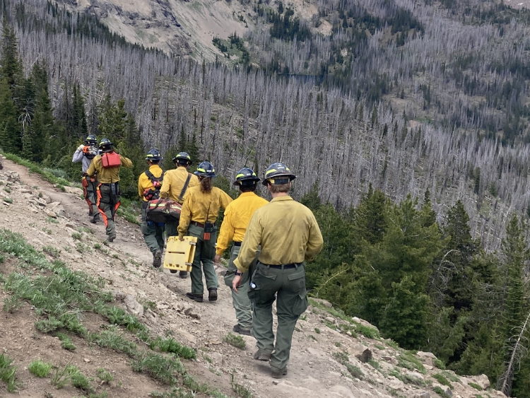
5. Strawberry Mountain WildernessThe Strawberry Mountain Wilderness Area, southeast of John Day by way of Prairie City, managed by the Malheur National Forest, is one of the newer wilderness areas in the nation, and certainly one of the most accessible. Approximately 10,000 people visit the wilderness each year. Thirty trails, covering nearly 125 miles, are available to assist in your exploration of this pristine area.
As you hike up, watch for wildlife such as Rocky Mountain elk, mule deer, antelope, black bear, cougar, California bighorn sheep, pileated woodpecker, sharp-shinned hawk, bald eagle, beaver, and many more. Be aware, however, that temperatures often dip below freezing even in the summer, and that you should bring your own drinking water for your hike.
6. Logan Valley LoopThe Logan Valley loop takes you on a journey around the Strawberry Mountain Wilderness area, through scenic valleys and along vibrant streams. From John Day, travel south on Hwy. 395 to the J-L Ranch, about eight miles south, and turn left on County Road 65. This becomes Forest Road 15 after about five miles. At the intersection with Forest Road 16, turn left and follow the old Oregon & Northwestern Railroad logging line grade east into Logan Valley and Summit Prairie. Turn left again on County Road 62, and follow it into Prairie City. Don’t forget to spend some time browsing the art and gift shops in this quaint Western town.
7. Blue Mountain Scenic BywayThis scenic drive takes you through some of the most remote, and most beautiful, areas of the county. Start at Prairie City and travel east on Hwy. 26 to Austin Junction, then turn onto State Route 7 to Greenhorn. From Greenhorn take Forest Road 73 through Granite to the North Fork John Day Campground. From here, head west on Forest Road 53 to Hwy. 395, where you end up about a mile north of Dale. Stop in at the local store for a snack, and then head south along Hwy. 395 to Mt. Vernon.
8. Magone LakeMagone Lake, about 26 miles northeast of John Day in the Malheur National Forest, is one of Grant County’s most popular lakes. The lake is filled with brook and rainbow trout for fishing, and a hiking trail circles the lake. A handicap-accessible campground and a boat ramp are also available.
9. Middle Fork John Day River LoopThis loop takes you along the Middle Fork of the John Day River, through pristine valleys. Follow Hwy. 26 east from Prairie City over Dixie Summit; don’t forget to take a few minutes and visit the Sumpter Valley Railroad historical exhibit near the pass. At Austin Junction, turn left onto State Road 7 for about a mile, and then turn left again onto County Road 20.
You’ll pass by the Forest and Oxbow Conservation Areas, where the land along the river is being restored to provide cover for wildlife and fish. The road ends at Hwy. 395 near Ritter. Take a moment to visit the Ritter Hot Springs; then, travel south along Hwy. 395 through Long Creek back to John Day.
10. North, Middle Forks Malheur RiverBoth the North and Middle Forks of the Malheur River are listed as feaderal Wild and Scenic areas, and each offers the opportunity to be in a place seldom visited. Both rivers offer the occasion for hiking and horseback riding.
To reach the North Fork of the Malheur River, take County Road 62 south of Prairie City, then Forest Road 16 west for approximately nine miles, then turn east on Forest Road 13 for approximately seven miles.
To reach the Middle Fork of the Malheur River, take County Road 62 south of Prairie City, then Forest Road 16 west for approximately five miles, then turn east on Forest Road 1647 and follow the signs south for approximately seven miles.
11. Cedar Grove Botanical AreaThe Cedar Grove Botanical Area in Eastern Oregon’s Aldrich Mountains covers about 26 acres and contains the only isolated stand of Alaska yellow cedar east of the Cascades in the United States. Because of the unique combination of weather, moisture, and other conditions in this one isolated spot, this small stand survived changes to hotter, drier weather. The cedar grove offers a cool, welcome respite from the heat of a hot, desertlike summer day.
The Cedar Grove Botanical Area is off Forest Road 21 (Fields Creek Road), which you can reach from Hwy. 26 about 10 miles west of Mt. Vernon. When you reach Fields Creek summit, turn right and follow Forest Road 2150 for about five miles west to the trailhead.


-
eEdition

-

-

