The road less traveled
Published 12:45 pm Tuesday, July 31, 2018
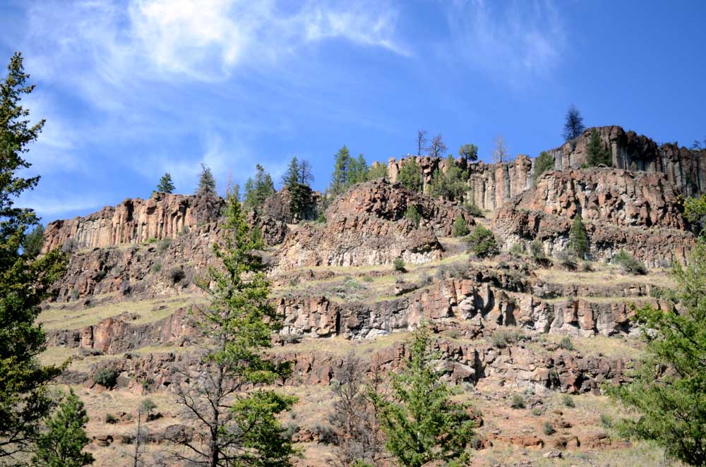
- Picturesque cliffs line much of the South Fork John Day River.
From the forest to high desert canyons, driving a peaceful loop from John Day through Izee and along the South Fork John Day River provides an array of different scenery.
South of John Day on Highway 395, the forest is desolate and scarred from a fire in 2015.
Continue on, and the foliage returns to the towering pines straddling the roadway.
The Swick Old Growth area will be ahead on your left if you need to stretch your legs, but this journey takes the Izee-Paulina Highway to the right through the northern edge of Bear Valley.
The highway will take you all the way to South Fork Road, where the trek turns to gravel.
But that’s not the first sign you’ll see for the South Fork on the Izee-Paulina Highway. The first sign directs you to the right onto Forest Road 24, which follows Deer Creek until it dumps into the South Fork and the road joins with South Fork Road. Save that route for another day, and continue on the highway.
The forest fades into the high desert of sagebrush and ranch land.
Past the old town of Izee — you might miss it — the highway makes its way north until its intersection with South Fork Road when it starts to turn southward. You’ll notice the change in direction, and a small, green road sign that reads “S Fork” marks the start of the journey on the gravel road that takes you through the canyons to Dayville.
The road, which was well maintained in early July, follows the South Fork John Day River the whole way. What looks like a creek that might wet your ankles at the start becomes a steady stream with swimming holes closer to Dayville — depending on water flows. Watch for rattlesnakes when you get out of your vehicle.
The route is lined with cliffs and interesting geological features. The colors and formations provide ample opportunities for photography.
Just before Forest Road 24 joins with South Fork Road, South Fork Falls can be heard — and seen if you stop — off to the right side of the road.
Farther along, you’ll come across the Black Canyon Trailhead, which leads into the Black Canyon Wilderness.
Continue on as the terrain continues to change until you reach Dayville, where you can turn right onto Highway 26 to return to John Day.
If the change in scenery has not been dynamic enough, you can head west from Dayville on Highway 26 through Picture Gorge and north on Highway 19 to Kimberly through the Sheep Rock Unit of the John Day Fossil Beds National Monument.
From Kimberly, take Highway 402 through Monument to Long Creek and turn south on Highway 395 to Mt. Vernon, where you can turn east to John Day.


