BIC access subcommittee off to ‘rocky’ start
Published 12:00 pm Tuesday, August 25, 2020
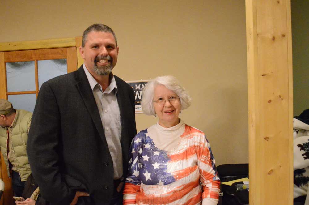
- Owens
With the Blues Intergovernmental Council breaking out into subcommittees to drill down on the issues that led to the Forest Service’s Blue Mountains Forest Plan demise, the access group is working on identifying which public roads are open or closed and by which authority public roads were closed.
Trending
Subcommittee member Rep. Mark Owens, R-Crane, said access, one of the most controversial subjects on the previous forest plan, will probably remain a hot-button area as they move forward.
“The access meetings have been a little bit rocky,” he said. “We’ve tried to talk about desired conditions, and where we want to go. We all get positional rather quickly.”
Forest Service Deputy Regional Forester Lisa Northrup said a “key focus” of the subcommittee is on how to provide access for “human needs and protect important habitat.”
Trending
“To that end,” she said. “Our committee will be working toward reaching zones of agreements that we will bring back to the full BIC as part of their full recommendations to (the Forest Service).”
In the subcommittee meeting notes, Northrup said the group should find out what people want regarding access.
The meeting notes state, “Travel management needs be separated from creating a forest plan to guide management.”
Owens said he understands certain areas have wilderness or wildlife designations restricting motorized vehicle access. But he wanted to learn what roads are open and what roads are closed and why they are closed.
He said he wanted to see which roads were closed through the National Environmental Policy Act and which roads were closed by the Forest Service administratively.
“If they’re closed through NEPA, we really can’t get it back open unless we go through NEPA, but if you’re closed administratively then those are open for a conversation to the subject,” he said.
Owens said the Forest Service had not “teased out” why the roads were closed and by which process when the group viewed a map of closed and open roads.
In the next monthly meeting, Owens said the group would pick one area of the Wallowa-Whitman National Forest to get a basic understanding of the access roads and how they were designated to be open or closed.
“In order to figure out where we’re going, we have to figure out where we’re at,” he said.
He said the group’s goal is to come to a common understanding when it comes to access so that county commissioners, partners and other stakeholders can share that information with their respective communities.
Association of Oregon Counties Solutions Director Greg Wolf, a subcommittee member, said access has a “long history of disagreement,” and it is essential that the group starts from a shared base of information to understand the existing conditions better.
“It is actually pretty complicated when you start trying to parse all that stuff out,” he said.
Owens said, while he is for an “open-forest designation,” he understands there will need to be compromises made as they move forward.
“We all can plan, moving forward, where we need to be. Of course, there’s a big difference of opinion of where we need to be,” he said. “Our general forest designation would be an open-forest designation, and we need the public to have access to it. But I am not bull-headed enough that there are sensitive spots in the area where we need to reroute a road or need to have seasonal closure for some migration. I’m OK with that, but I need to understand the impact on the forest by knowing where we’re at today.”
“We all can plan, moving forward, where we need to be. Of course, there’s a big difference of opinion of where we need to be. Our general forest designation would be an open-forest designation, and we need the public to have access to it.”
—Rep. Mark Owens, Blues Intergovernmental Council access subcommittee member
Marketplace


-
eEdition

-

-
