JOURNEY: Sheep Rock Unit showcases millions of years of history
Published 10:00 am Thursday, July 29, 2021
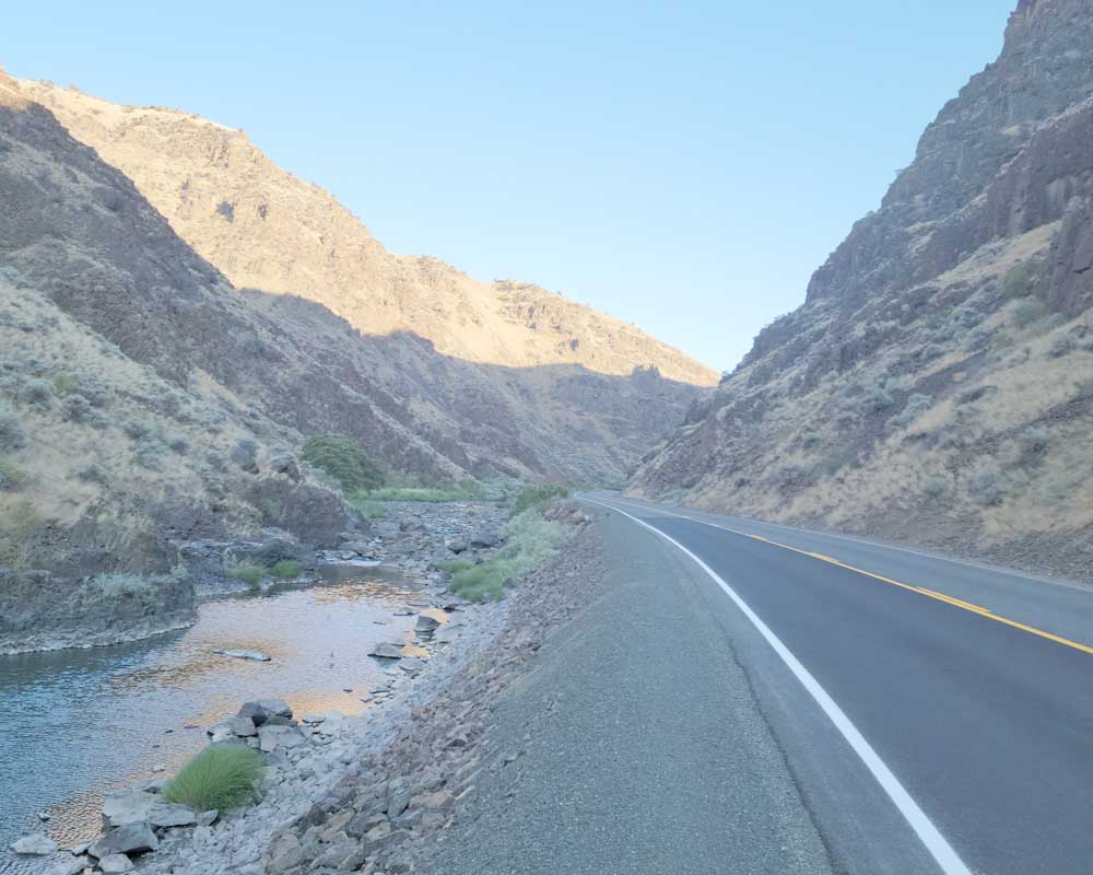
- The drive to the Painted Hills from John Day goes through Picture Gorge. According to paleontologists, the John Day River carved the deep but short canyon through a faulted uplift of Columbia River basalt.
The John Day Fossil Beds National Monument, with its multicolored hills, towering cliffs, canyons and fossil-rich areas, showcases more than 40 million years of geological history.
The monument’s 14,000-acre preserve dates back to when the semi-arid desert landscape area was semitropical.
The monument is broken into three units across Grant and Wheeler counties, including Clarno, Sheep Rock and Painted Hills.
First-time visitors to the park cannot go wrong with Sheep Rock, the central hub of the monument. There one can find the Thomas Condon Paleontology Center and Cant Ranch. At either the office at Cant Ranch, which is the monument’s headquarters or the visitor center, one can pick up maps and brochures to get started.
The drive from John Day to Sheep Rock is about 45 minutes. The most direct route is Highway 26, passing through Mt. Vernon and Dayville and then north on Highway 19 through Picture Gorge, traveling 4 miles along the John Day River.
Blue Basin Trailhead is tucked away on the far north side of Sheep Rock and offers a pair of hikes. One can choose the more challenging Blue Basin Overlook Trail at the trailhead, about a three and a half mile loop. Or the more accessible Island in Time Loop, a little over a mile roundtrip.
The complex colors of the claystone ranges, a soft seafoam green, walking into the canyon are breathtaking.
The overlook trail climbs a moderate grade and then cuts east into the stunning canyon carved by erosion into beds of gray-blue sedimentary rocks. They form the John Day Formation, which comprises a multitude of reworked layers of volcanic ash.
According to the monument’s website, the rich green color of the claystone was caused by the chemical weathering of a mineral called celadonite.
The interpretive signs lining the trail are worth reading and bring the experience to a whole new level to learn about the past.
The trails at Blue Basin also feature fossils and casts of ancient animals, many found just beneath the surface of the blue-green rock.
The basin is also known as Turtle Cove, as the fossils found in this area include many from ancient turtles.
Upwards of 50 million years ago, hundreds of different nuts and fruit trees thrived in what was then a wet and warm climate, and there was food for dozens of species of ancient insects, birds, amphibians and mammals. There were tiny three-toed horses, armor-plated crocodiles and the first known land tortoises, and big cats that weren’t cats at all. As those animals died off, they collected under layers of volcanic ash and rock.
Today, the trails of Blue Basin feature many fossils and casts of those ancient animals.
As the trail climbs higher in elevation it kicks out to where the vista becomes apparent on the overlook trail.
The surrounding painted hills grow up from the valleys below, banded with rust-colored earth and layered with blotches blue of green and green.
A photo does not do it justice.
Driving directions
From Dayville: Travel west on Highway 26 6.9 miles to the Highway 19 junction in Picture Gorge. Turn right at the junction. The Thomas Condon Paleontology Center and Cant Ranch is 2.1 miles north. Approximately 3 miles farther, clearly marked with a brown metal sign, is the Blue Basin Trailhead, which includes paved parking, a picnic area and restrooms, but no water.
Traveling a short distance farther north is the breathtaking Cathedral Rock and, shortly after, the Foree Area’s Flood of Fire and Story in Stone trails.
The Flood of Fire (0.4 miles round trip) has a gravel trail with a viewpoint overlooking the John Day River Valley and a colorful rock formation similar to Cathedral Rock.
The Story in Stone (0.3 miles round trip) trail, which is partially paved, skirts above a small basin of blue-green claystone. Like the Blue Basin, the formation contains fossils of animals that lived in there 25 to 30 million years ago.