Updated: Malheur National Forest prepares to start fall prescribed burning
Published 4:00 pm Thursday, September 14, 2023
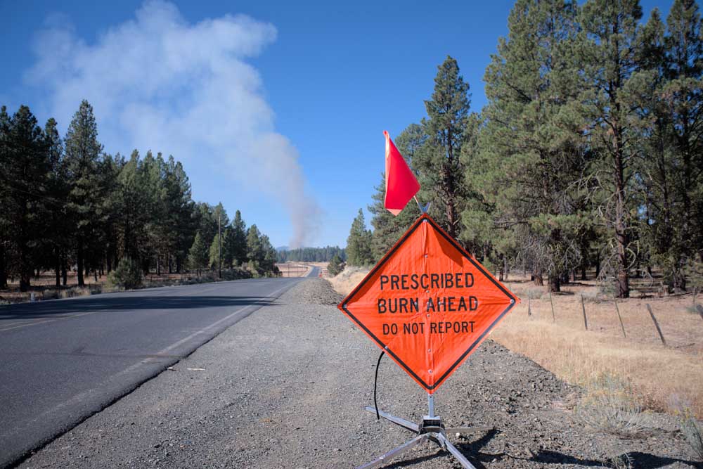
- A sign along the Izee-Paulina Highway, County Road 63, the afternoon of Oct. 19, 2022, shows the smoke column from a prescribed burn underway on Malheur National Forest land.
JOHN DAY — Fire management officials on the Malheur National Forest are preparing to implement the forest’s fall prescribed burning program.
Units that are being monitored for potential burning, of which a portion will be completed as conditions allow, are:
Blue Mountain Ranger District:
Galena 41 and Galena 40C are planned for approximately 735 total acres. Located 7.5 miles northwest of Austin Junction and 12 miles east of Galena, along Forest Road 2055.
Soda Bear 9C and Soda Bear 9G are planned for approximately 405 total acres. Located off Forest Road 1619 in Bear Valley.
Damon 2A is planned for approximately 485 acres. Located off Highway 395 and Forest Roads 3925 and 11.
Starr 31, 31 ADD, 32 and 33 are planned for approximately 1,387 acres. Located on Forest Road 24. These units will be implemented through a contract.
Emigrant Ranger District:
Wolf H is planned for approximately 713 acres. Located near Forest Roads 17 and 15, 20 miles northeast of Drewsey.
UpRatt 5G is planned for approximately 2,445 acres. Located off Forest Roads 28, 2815 and 2850 near Perry Meadows.
Marshall Devine D is planned for approximately 2,000 acres. Located near Idlewild Campground.
Prairie City Ranger District:
Summit 13 and Summit 12 are planned for approximately 3,000 total acres. Located 4 miles southwest of Summit Prairie, along Forest Road 1,651.
Elk 16C is planned for approximately 950 acres. Located at the junction of Forest Rroads 16 and 1675.
Each prescribed burn is designed to accomplish specific objectives related to increasing forest health. Prescribed burns will be conducted only under appropriate conditions to ensure safety, according to forest managers. These conditions include temperature, wind, fuel moisture and smoke weather forecast. When all these criteria are met, firefighters implement, monitor and patrol the burn to ensure it meets forest health and public safety goals, including air quality.
As desired conditions are met, detailed information will be released on prescribed burns that will be conducted. Prescribed fire information for the Malheur, Umatilla and Wallowa-Whitman national forests is available to the public on a tri-forest online map. The map is labeled and color-coded to show each burn unit’s status: planned, active or completed. Additionally, forest users can view other features, including current and past-year burn units, national forest boundaries and state wildlife management boundaries.
The Forest Service recognizes that hunting seasons coincide with prescribed burning season and that it can impact hunters, but forest managers say controlled burns are necessary to reintroduce fire to the landscape and encourage healthy vegetation that will ultimately improve landscapes and forage for big game. Hunters should use caution when entering a recently burned are and be aware of the increased hazards, particularly snags. Dead or dying trees that remain standing after a fire are unstable, especially in high winds.


-
eEdition

-

-

