Quake Questions: Scientists deploying latest technology to gauge earthquake hazards in Northeast Oregon
Published 3:00 pm Thursday, February 8, 2024
- The U.S. Forest Service is revising the long-term management plans for the three national forests in the Blue Mountains — Wallowa-Whitman, Umatilla and Malheur.
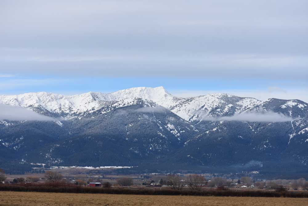
BAKER CITY — In the dark of a bitter January night, among the sagebrush and the junipers about 11 miles southeast of Baker City, the earth moved.
It was, as earthquakes go, a decidedly modest event.
Seismographs pegged the magnitude of the quake, which happened at 1:41 a.m. on Jan. 8, at 2.5.
“That’s about the threshold for people to feel, and definitely way lower than what would cause damage,” said Doug Gibbons, a research engineer at the Pacific Northwest Seismic Network, which is operated by the University of Washington and University of Oregon.
That network consists of about 600 seismographs in Oregon and Washington. Most are on the west side of those two states.
No one reported feeling the quake, according to the U.S. Geological Survey.
Three days earlier, at 9:58 a.m. on Jan. 5, another, even weaker, temblor happened about half a mile to the northwest of the Jan. 8 quake. It was measured as magnitude 1.9.
A little more than a month before, on Dec. 2, 2023, an even weaker quake, magnitude 1.7, was recorded about 6.5 miles southeast of Baker City, near Sutton Creek.
And on Oct. 14, 2023, about 2 miles south of the Jan. 8 quake, a magnitude 2.3 event was recorded.
Four tiny quakes, none of which resulted in any public reports, happened within a roughly 5-mile radius during a 3-month period.
All occurred between 4.3 miles and 4.8 miles below the ground.
Was there a connection, anything which might imply future quakes, and potentially more powerful ones, were likely in the vicinity?
The answer, almost certainly, is no, said Lalo Guerrero, geology hazard specialist for the Oregon Department of Geology and Mineral Industries (DOGAMI).
Every day around the world, there are dozens of quakes, he said — temblors so minor they aren’t felt by people but are detected by much more sensitive seismographs, which can record these quakes even at great distances.
(The seismograph nearest the recent quakes southeast of Baker City is near Ladd Canyon, about 40 miles away; it and several other seismographs measured the four small quakes near Baker City.)
Neither of the three later quakes was an aftershock from the Oct. 14 event, Guerrero said.
The magnitude 2.3 quake on Oct. 14 was far too small to generate aftershocks, he said.
The location and timing of the quartet of quakes likely reflects mere coincidence, Guerrero said.
Geologist Jason McClaughry, geological survey and services program manager for DOGAMI’s Baker City office, calls such quakes “individual events.”
They have no direct connection to temblors past or future, McClaughry said.
The four quakes show only that faults — cracks in the earth’s crust caused when tectonic forces break rocks, resulting in a quake — exist in the area, but that was no surprise to geologists, McClaughry said.
Geologists mapped that area, primarily in the 1970s, and although they found evidence of faults, based on displacement of rocks visible on the surface, none was described as a large fault — one that could generate a potentially damaging quake, he said.
And although McClaughry and Guerrero agree that geologists have relatively scanty detail about faults in that area, including their age and history of quakes, Guerrero said the absence of any large “scarps” — a step in the landscape that forms when two blocks of rock along a fault move vertically — suggests that the faults have generated relatively modest quakes.
Typically only temblors of magnitude 6 or higher create fault scarps, Guerrero said. Quakes of magnitude 5 or higher can result in damage.
There hasn’t been a quake with a magnitude higher than 3.7 recorded in Northeast Oregon in the past half century.
But there have been such quakes in the past, as fault scarp mountains, including the Elkhorns west of Baker City, and mountains on the edges of the Grande Ronde Valley, indicate, Guerrero said.
Faults, stress and quakes
In the simplest explanation, a fault is a fracture, or series of fractures, between blocks of rock that move relative to each other.
In some faults, rocks move sideways. In others, rocks on one side of the fault move upward, while those on the other drop.
Regardless of the type, pressure can accumulate along a fault as the rocks, being relatively stout, resist the inexorable movements of tectonic “plates” that, like the pieces of an immense puzzle, make up the Earth’s crust. When that stress reaches a certain point the rocks break, or slip.
That’s an earthquake.
Consider this analogy: You’re trying to break loose a rusty bolt, really putting your back into it, when the bolt finally lets go. You can’t react that fast and so you bang your elbow against the nearest hard (and probably sharp) object.
Generally speaking, the longer the section of fault that gives way during a quake, the greater the magnitude, Guerrero said.
Faults, and the quakes they spawn, can, over millions of years, create significant mountains and valleys.
A fault along the western edge of Baker Valley, for instance, over the past 7 million years or so has caused the Elkhorn Mountains to rise more than 3,000 feet while the valley has dropped.
Fault zones on the west and east sides of the Grande Ronde Valley have had similar effects, leading to the mountains — fault scarps — that rise on both sides of the valley.
According to a 2010 study by DOGAMI, faults on the west side of the Grande Ronde Valley could potentially produce earthquakes up to magnitude 7.
McClaughry points out that predictions of the earthquake potential for a particular fault, or fault zone, depends considerably on the types of data available to geologists.
Much of the data for Northeast Oregon derives from field studies done in the 1960s and 1970s, which is of limited value in predicting earthquake potential, he said.
One of the challenges in both the Baker and Grande Ronde valleys is that deep layers of sediment covers much of the valleys.
“So much of the geology is buried by sedimentary fill,” he said. “We can map the fringes but we don’t know as much about the valley.”
Newer technology, however, such as LIDAR — Light Detection and Ranging, which can produce extremely detailed maps of the ground surface — as well as magnetic field variation surveys, which can help geologists analyze rock layers, and faults, far below the surface, will significantly add to geologists’ knowledge of faults, McClaughry said.
Over the past several years, the U.S. Geological Survey has done surveys of that type in the Pendleton area, the Grande Ronde Valley and, starting in 2023, in Baker Valley.
Columbia Basin survey and Northeast Oregon’s biggest recorded quake
Guerrero has been studying the geology, and earthquake hazards, in an area of the Columbia Basin from east of Milton-Freewater west and northwest to the Columbia River near Wallula Gap. The study area covers 50 to 70 square miles.
The area includes the fault near Milton-Freewater that produced Northeast Oregon’s most powerful recorded quake. It happened at 11:08 p.m. on July 15, 1936, and was recorded at 17 seismographs. Geologists estimate the magnitude at 6.1.
The quake, which was followed by four significant aftershocks, on July 18, Aug. 4 and Aug. 28, caused major damage in Milton-Freewater, Umapine and Stateline.
Shaking damaged chimneys, shifted homes off their foundations and caused damage estimated at $100,000, according to DOGAMI documents.
The quake also caused the ground to crack in many places, some of which were several feet wide. In one place the ground dropped by nearly 10 feet.
Guerrero said the current study, which builds on geologic mapping done by McClaughry and others, will examine faults in the area, known as the Wallula fault zone, in greater detail than ever before.
Although geologists are still collecting data, Guerrero said that once he and others have analyzed the information, which he hopes will happen later this year, they will have a much better sense of the earthquake risk in that region.
“I’ll feel more comfortable in my understanding of the earthquake hazards of this particular fault zone,” he said.
Among the questions Guerrero hopes to answer through the study is how many significant quakes have happened in the fault zone over the past 12,000 years or so, and whether, based on a study of the faults, whether any were likely of magnitude 6 or higher.
Geologists can estimate the magnitude of historical temblors with some degree of precision based on such things as the extent of rock displacement, he said.
By assembling a history of quakes, geologists can estimate the probability of a significant quake in the future, Guerrero said.
He emphasizes, though, that predicting earthquakes is vastly different, in terms of precision, than, say, predicting weather.
“Prediction is the ultimate goal for earthquakes; however, the current state of the science and technology can at best provide a forecast as to a potential timeframe or a probability as to when an event might occur,” Guerrero said.
But even with the limitations of predictions, a rough idea of how strong quakes could be in a particular area help experts assess the relative risk of damage to buildings.
Several factors affect that risk, including the type of ground on which a structure sits.
Generally speaking, shaking can cause more damage to buildings in places underlain by gravelly or sandy soil — as in much of the Baker and Grande Ronde valleys, rather than by solid bedrock.
As for buildings themselves, multi-story buildings made of unreinforced stone or brick are more likely to be damaged during a quake than are single-story buildings with wood or steel frames.
Back to the recent quakes near Baker City
Significant quakes such as the 1936 event near Milton-Freewater are rare.
The quartet of quakes southeast of Baker City over the past few months, by contrast, is more typical of the region’s seismic situation.
According to data from the Pacific Northwest Seismic Network, since 1969 there have been 258 quakes in an area that includes all or most of Baker, Grant, Union, Wallowa, Umatilla and Morrow counties.
The vast majority of those quakes were too small to be felt by people.
Just 16 of the 258 temblors measured magnitude 3.0 or higher, the strongest being 3.7, on Jan. 23, 2015, about 12 miles east of Pendleton.
According to DOGAMI, quakes of magnitude 3.0 to 4.9 often are felt by people, but rarely cause damage.
Several quakes in the past few decades were reported by residents as well as by seismographs.
On Oct. 1, 2003, a magnitude 3.1 quake happened near Love Reservoir, about 17 miles east of Baker City.
Residents near Richland told the Baker City Herald that they felt the quake, although it didn’t cause any damage.
Mark Ferns, a since-retired geologist who worked at DOGAMI’s Baker City office and has assessed earthquake hazards in the Grande Ronde and Baker valleys, said in 2003 that he suspected the quake happened on a fault that geologists have not studied in detail.
Eastern Baker County has been one of Oregon’s more seismically active regions over the past few decades, although none of the quakes was particularly powerful.
Residents in the Pine and Eagle valleys did report feeling several quakes during the 1990s.
During that time a network of seismographs that included seven in Oregon and 12 in Idaho operated. That network no longer operates.
Geologists have mapped a series of faults in the area, including one that runs beneath Brownlee Dam.
Pine Valley, where the town of Halfway sits, was, like the Baker and Grande Ronde valleys, formed by faults.
Causes for local quakes
Guerrero said that although the lack of detailed geologic mapping means geologists can’t say for certain what triggered the four recent temblors near Baker City, it’s likely that the seismic stress that accumulated on the individual faults originated far away.
There are two sources of stress in the region, he said.
The largest is the westward movement of the North American “plate” — one of those massive chunk of the Earth’s crust, and the one we’re standing on.
Geologists concluded more than half a century ago that the crust is divided into segments called plates. These move — albeit exceedingly slowly, roughly at the rate of a fingernail’s growth.
As the North American plate creeps west, it causes stress to build up on faults both large and, like those southeast of Baker City, comparatively small, Guerrero said.
Occasionally that pressure causes a fault, or section of fault, to give way, resulting in a quake that likely goes unnoticed except by seismographs, he said. Most of these, like the four recent temblors near Baker County, are what seismologists call “shallow” quakes, happening less than 10 miles below the ground. (The place on a fault where rocks break is the “focus.” The familiar word “epicenter,” by contrast, is the point on the surface directly above the focus.)
The second source of seismic stress is in the southeast part of Oregon, which is part of the Basin and Range. In that region, which extends into parts of Idaho and most of Nevada, the crust is stretching — “extension,” as geologists call it.
This movement can also cause pressure to accumulate along faults in Northeast Oregon, Guerrero said.
The bottom line, then, is that distant and much more powerful geologic forces — the movement of plates — can increase pressure on thousands of faults hundreds of miles away.
Oregon’s biggest, by far, earthquake hazard
The Cascadia subduction zone is a 700-mile-long fault that stretches from northern California to British Columbia about 70 to 100 miles off the Pacific coast.
Along that fault, a section of the Juan de Fuca plate is plunging beneath the much larger North American plate, a process geologists call subduction.
Given the length of that fault, it’s capable of generating catastrophic quakes and tsunamis. Geologists have concluded that there have been 43 quakes on the subduction zone fault within the past 10,000 years.
The most recent, with an estimated magnitude of 9.0, happened on Jan. 26, 1700. Geologists can be that precise because of Japanese written records of the tsunami that resulted from the quake and traveled across the Pacific Ocean.
Quake information online
The Oregon Department of Geology and Mineral Industries website has a variety of information related to earthquakes in the state, including maps showing the relative hazard, earthquake history and more.
• www.oregon.gov/dogami/earthquakes/Pages/earthquakehome.aspx
Another online resource is the U.S. Geological Survey’s “Did You Feel It” website, which includes reports about recent earthquakes around the U.S. and world, and allows users to file a report if they felt a quake.
• https://earthquake.usgs.gov/data/dyfi/
Earthquake history in Northeast Oregon
Since 1969 there have 258 earthquakes recorded in an area that includes all or most of Baker, Grant, Union, Wallowa, Umatilla and Morrow counties, according to data from the Pacific Northwest Seismic Network.
{p class=”p1”}{span class=”s1”}Most were too weak to be felt by people. Just 16 of the 258 temblors measured magnitude 3.0 or higher, the strongest being 3.7, on Jan. 23, 2015, about 12 miles east of Pendleton. Although it depends on the distance from the epicenter, the depth below ground of the quake, and other factors, people generally don’t feel quakes below magnitude 3.{/span}
{p class=”p1”}{span class=”s1”}A list of quakes in the region of magnitude 3 or higher since 1969:{/span}
{p class=”p1”}{span class=”s1”}• March 8, 2023, 3.1, 27.2 miles east/southeast of Baker City, 3 miles deep{/span}
{p class=”p1”}{span class=”s1”}• Aug. 14, 2017, 3.1, West Fork Pine Creek, about 3 miles north of Cornucopia, 5.1 miles deep{/span}
{p class=”p1”}{span class=”s1”}• Jan. 23, 2015, 3.7, 12 miles east of Pendleton, south of Adams, 12.2 miles deep{/span}
{p class=”p1”}{span class=”s1”}• Nov. 3, 2014, 3.1, 2 miles east of Joseph, 1.7 miles deep{/span}
{p class=”p1”}{span class=”s1”}• July 5, 2009, 3.4, southeast of Malheur Reservoir, about 34 miles from Baker City, 4.2 miles deep{/span}
{p class=”p1”}{span class=”s1”}• Oct. 1, 2003, 3.1, near Love Reservoir, 17 miles east of Baker City, 13 miles deep{/span}
{p class=”p1”}{span class=”s1”}• Nov. 16, 2002, 3.1, 54 miles northeast of Baker City, 5.6 miles deep{/span}
{p class=”p1”}{span class=”s1”}• Nov. 15, 2002, 3.4, 53 miles northeast of Baker, near Hells Canyon Reservoir, 5.6 miles deep{/span}
{p class=”p1”}{span class=”s1”}• Aug. 27, 2000, 3.3, 22.8 miles east/southeast of Baker City, 0.29 miles deep{/span}
{p class=”p1”}{span class=”s1”}• July 13, 2000, 3.1, about 8 miles northwest of Unity, 11.3 miles deep{/span}
{p class=”p1”}{span class=”s1”}• March 3, 1999, 3.0, about 6 miles east of Wallowa Lake, 11.2 miles deep{/span}
{p class=”p1”}{span class=”s1”}• July 21, 1998, 3.1, almost same area, 0.45 miles deep{/span}
{p class=”p1”}{span class=”s1”}• July 19, 1998, 3.0, about 5 miles north of Halfway, 0.46 miles deep{/span}
{p class=”p1”}{span class=”s1”}• June 17, 1984, 3.1, 30.5 miles south of Pendleton, 6 miles deep{/span}
{p class=”p1”}{span class=”s1”}• July 7, 1975, 3.2, 8 miles east of Milton-Freewater, 4.7 miles deep{/span}
{p class=”p1”}{span class=”s1”}• July 13, 1971, 3.5, about 2 miles west of North Powder, 10.5 miles deep{/span}
“Prediction is the ultimate goal for earthquakes; however, the current state of the science and technology can at best provide a forecast as to a potential timeframe or a probability as to when an event might occur.”
— Dr. Lalo Guerrero, geology hazard specialist, Oregon Department of Geology and Mineral Industries


-
eEdition

-

-

