Forest Service proposes logging, thinning near Sumpter, Halfway
Published 1:00 pm Friday, April 12, 2024
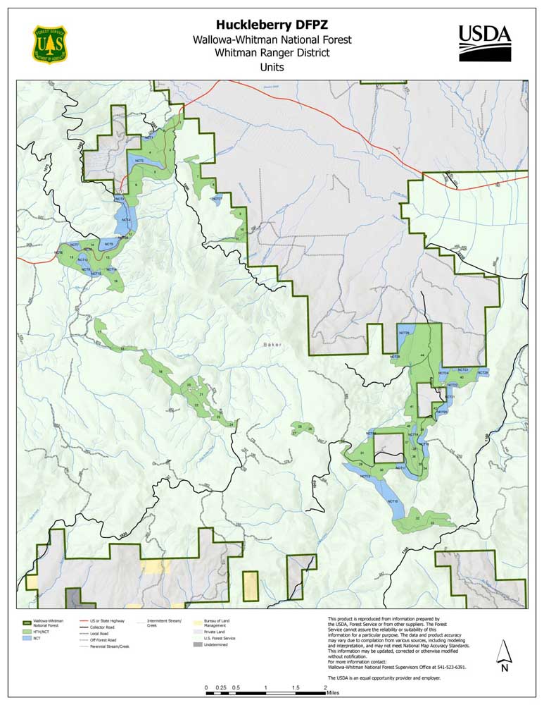
- Map shows areas proposed for logging and noncommercial thinning in the Sumpter Valley area.
BAKER CITY — The Whitman Ranger District has scheduled two open houses to give residents information about proposed projects designed to reduce the wildfire risk near Sumpter and Halfway.
Both projects would include commercial logging, noncommercial thinning of smaller trees, and prescribed fires.
The goal is to create a “defensible space” — an area where firefighters would have a better chance to stop a wildfire before it threatens homes.
There are two projects, both of which could start this summer.
• West Wall — near Halfway. The open house will be Wednesday, April 17, from 5 p.m. to 7 p.m. at the Halfway Lions Club, 235 Lions St. in Halfway.
More information: www.fs.usda.gov/project/wallowa-whitman/?project=65581.
• Huckleberry — near Sumpter. The open house is set for Thursday, April 18, from 5 p.m. to 7 p.m. at the Powder River Rural Fire District’s Mosquito Flats station at 39744 Sumpter Valley Highway (just west of the Highway 7 junction, about 27 miles west of Baker City).
More information: www.fs.usda.gov/project/wallowa-whitman/?project=63523.
In both projects, the Forest Service’s chief goal is to create defensible spaces along major roads and near homes.
The Huckleberry project focuses on areas along Highway 7 between Sumpter Valley and Larch Summit, Forest Road 11 (Skyline Road) west of Highway 7, and along Clear Creek south of Phillips Reservoir.
The project encompasses about 3,000 acres, with commercial logging proposed on about 2,300 acres, and noncommercial thinning on about 700 acres.
A Forest Service document notes that Baker County’s Community Wildfire Protection Plan calls for creating safe evacuation routes, in case of wildfire, along Highway 7 and the Skyline Road. There are many homes near the road, primarily east of the Black Mountain Road.
The logging and noncommercial thinning would “reduce tree density, favoring fire resistant tree species, and reduce existing fuels, as well as reduce live fuels that favor torching and crown fire,” according to the Forest Service proposal.
The West Wall project is named for the steep, forested area west of Halfway and the Pine Valley.
The project covers about 2,800 acres, with commercial logging planned on almost 1,800 acres and noncommercial thinning on about 1,000 acres.
The goal, according to a Forest Service document, is to “restore and maintain a fire resistant landscape sufficient to minimize the risk and damage caused by wildfire” within the wildland-urban interface — the area where homes are build within or near forests.
Spring prescribed burning
The Wallowa-Whitman National Forest is also planning prescribed burning this spring around the forest.
A map showing areas that could be burned is available at www.fs.usda.gov/wallowa-whitman.
Timing depends on weather and other factors.