Evacuation zones expanded for Rail Ridge Fire
Published 9:18 am Friday, September 6, 2024
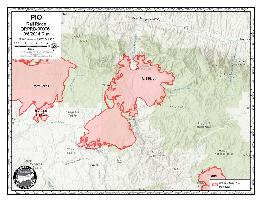
- rail ridge fire map 240906
DAYVILLE — Evacuation zones continue to expand ahead of the fast-moving Rail Ridge Fire south of Dayville.
The Level 3 “Go Now” alert has been extended northeast to Fields Creek from Murderers Creek in the south to Wickiup Creek in the north, the Grant County Emergency Management Office announced on Friday, Sept. 6.
The Level 2 “Be Set” alert has been extended northeast from Forest Service Road 2150 in the south to Highway 26 in the north and form Flat Creek in the west to Fields Creek in the east. This includes all residents in the Widows Creek basin.
Planning for a Red Cross shelter in Mt. Vernon is complete. The public will be notified when and if it is opened, officials said.
The Rail Ridge Fire, which started with a lightning strike near the South Fork John Day River on Monday, is now an estimated 107,371 acres.
For regular updates, visit the Grant County Emergency Management Facebook page at https://www.facebook.com/p/Grant-County-Emergency-Management-100068819321423/; call the information line at 541-575-2885; or email the Emergency Operations Center at GCEOC@grantcountyor.gov.
Access the active GIS map online at: https://oregonoem-geo.hub.arcgis.com/


