Wallowa-Whitman proposing to salvage trees burned in Town Gulch Fire
Published 1:00 pm Tuesday, November 26, 2024
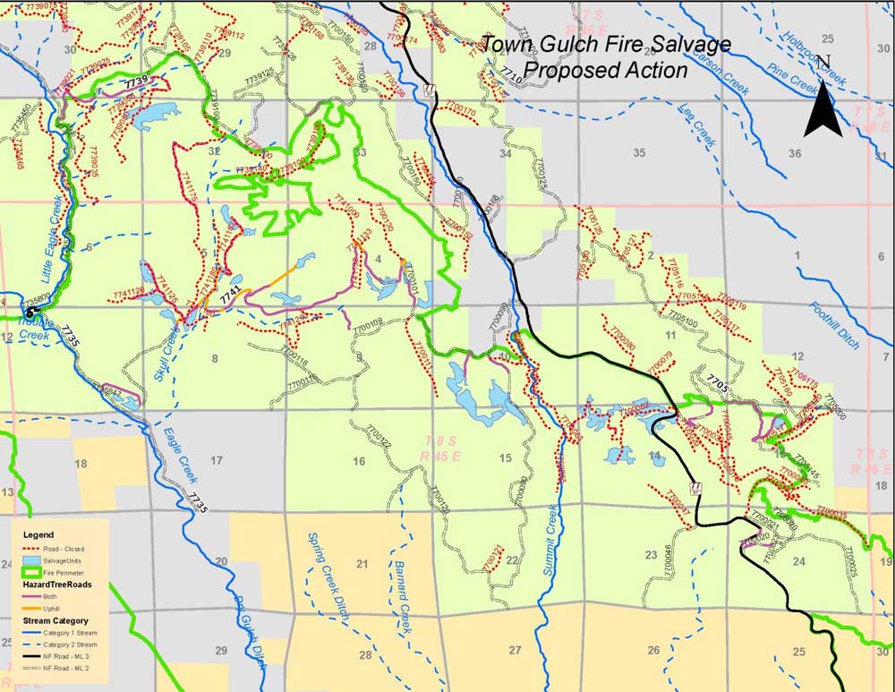
- TownGulchSalvageProposed Action.jpg
BAKER CITY — Officials from the Wallowa-Whitman National Forest are proposing to log trees killed or burned in the Town Gulch Fire this summer in eastern Baker County.
Trending
The blaze, started by lightning on Aug. 5 along Eagle Creek several miles north of New Bridge, burned about 18,500 acres. About half of the acres, 9,220, are part of the Wallowa-Whitman.
Salvage logging is proposed on about 250 acres, as well as within 150 feet of several Forest Service roads totaling about 10.5 miles.
Jeremy Aujero, the Whitman District ranger, said on Wednesday, Nov. 13, that he hopes to make a decision about the project by late February or early March.
Trending
“We’re looking at our options and our opportunities,” Aujero said.
Trees killed by fire deteriorate rapidly, losing both their value as lumber and making them more likely to fall across roads, according to the Wallowa-Whitman’s proposal.
Aujero said one goal with the project is to ensure that valuable timber is available to the local lumber industry if possible.
Most of the salvage logging is proposed for the east and west sides of Summit Creek, close to the fire’s eastern perimeter, as well as to the west near Skull Creek and Little Eagle Creek.
Forest officials plan to use a federal law that allows for a less-detailed environmental study for salvage logging projects that don’t exceed 250 acres.
Typically the agency has to write an environmental assessment or environmental impact statement for timber sales. Those studies can take more than a year.
Forest officials are proposing what’s known as a “categorical exclusion” for the Town Gulch salvage project.
However, Aujero said his decision about whether to proceed with a categorical exclusion, or whether a more detailed environmental study is warranted, will be based on surveys by Whitman District staff.
Of the 9,200 or so acres of national forest land burned, around 3,000 acres are timbered, Aujero said. The forests include a mixture of ponderosa pine, Douglas-fir and grand fir. Most of the trees slated for potential salvage are ponderosa pines, Aujero said.
Some of the burned trees are larger than 21 inches in diameter, he said. A Forest Service policy dating to the early 1990s known as the eastside screens restricts cutting of live trees larger than 21 inches, with exceptions for trees that could pose a danger to the public.
Aujero said the 21-inch restriction doesn’t apply to trees killed by the fire.
Among the possibilities with the project are a commercial timber sale and designating a firewood cutting area, Aujero said.
The Wallowa-Whitman is accepting written comments about the proposal through Nov. 21. More information about the proposal, including links for submitting comments, is available at fs.usda.gov/project/wallowa-whitman/?project=67261
The fire
The Town Gulch Fire made its major run on the afternoon and evening of Aug. 6, when it spread several miles south along Eagle Creek as well as east, where it moved down the West Wall to near the edge of Pine Valley.
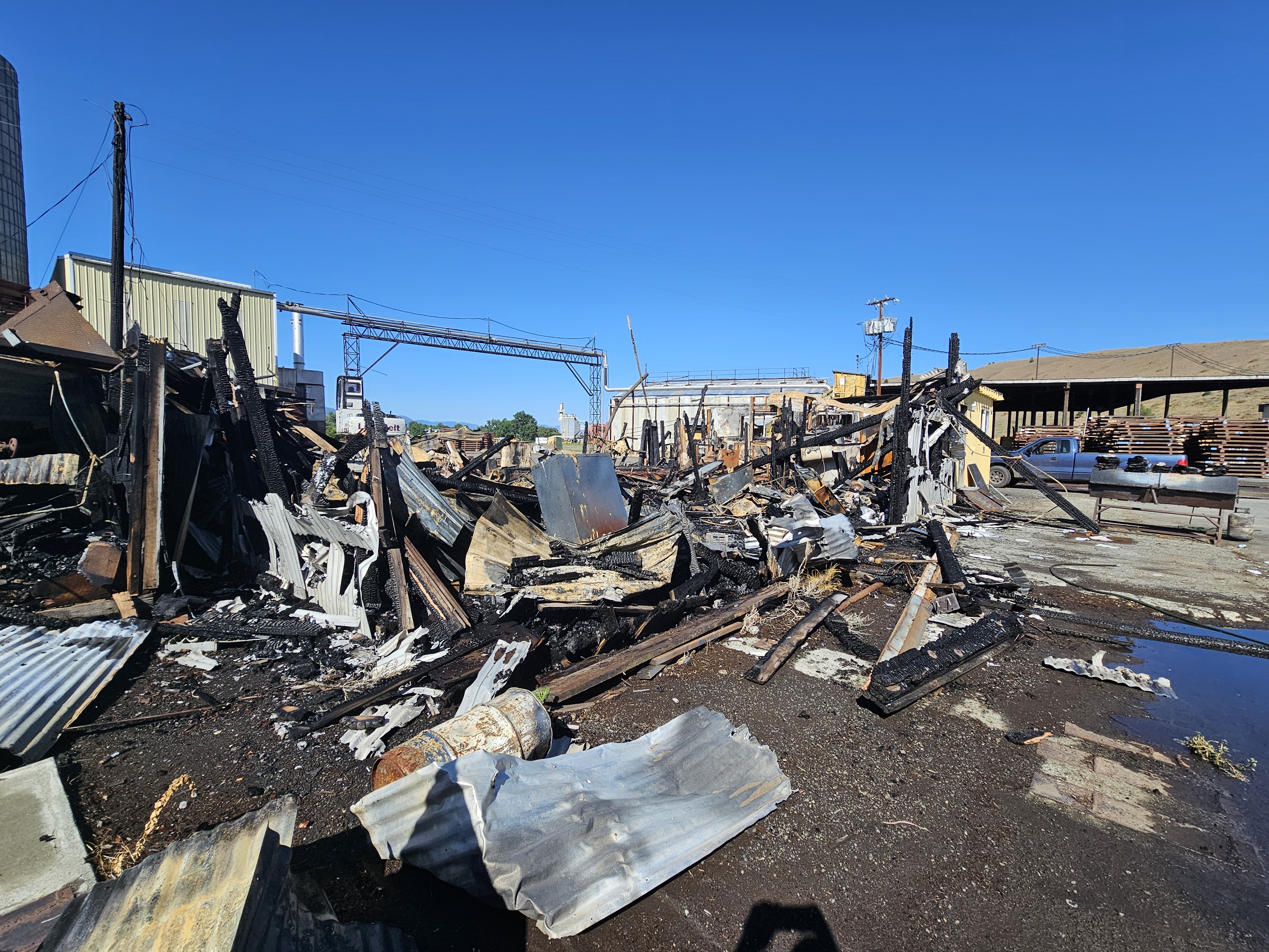
The fire destroyed four structures, and evacuation notices were in effect for more than a week.
The fire was largely contained by the middle of August.
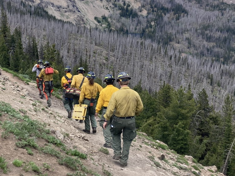
There were no serious injuries to the public or to firefighters.
Forest Service employees have estimated that more than three-quarters of the area burned did not have severe damage to the soil, which means a relatively low risk of mudslides if heavy rain falls.
Almost one-quarter of the 18,500 acres had a moderate burn severity, and less than 1% (86 acres) burned at high severity.
Those are among the initial findings of the Burned Area Emergency Response (BAER) team working on the Town Gulch Fire.
The team, led by Mary Young and Jamie Krezelok, started its survey on Sept. 5.
BAER teams arrive soon after a wildfire is extinguished to assess fire damage with an emphasis on the risk of mudslides and flooding if heavy rain falls on severely burned slopes where there is little or no vegetation left to stabilize the soil.
The BAER team’s map for the Town Gulch Fire shows:
• Very low burn severity (or unburned): 2% (337 acres).
• Low burn severity: 74% (13,707 acres).
• Moderate burn severity: 24% (4,396 acres).
• High burn severity: less than 1% (86 acres).
Areas of moderate burn severity are scattered around the fire area, with concentrations near the Eagle Creek Canyon and on the West Wall west of the Pine Valley, and in the northern part of the fire near Skull Creek.


-
eEdition

-

-
