A dazzling introduction to snowshoeing
Published 9:00 am Sunday, December 8, 2024
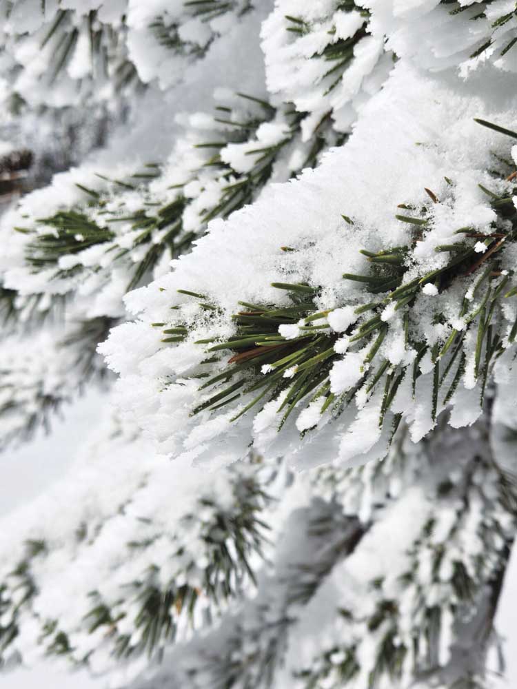
- A snow-flocked subalpine fir tree near Hoffer Lakes.
Snowshoeing always fools my internal thermostat.
I shiver as I step out of the car and kneel to tighten the straps.
And for the first few minutes of walking, as the breeze freezes my cheeks, I wish I had donned another layer.
Or two.
But invariably the exertion overcomes the environment, a thermodynamic tussle with a guaranteed winner.
The physical toil, to put it another way, generates a surplus of heat.
I feel beads of sweat on my neck.
I consider doffing the down jacket, and sometimes do.
Snowshoeing is easy in one sense but can be hard in another.
It’s easy because it requires no special athletic ability. Snowshoeing is basically walking — albeit walking with potentially clumsy contraptions affixed to your boots.
But it can be hard because snow is stubborn.
Implacable.
Not infrequently annoying.
Even the most cleverly designed snowshoe must yield to the dictates of physics.
I never studied physics — my high school science teachers forbade it, having witnessed with horror my attempt to understand chemistry — so I can’t cite the particular properties involved.
Suffice it to say that snow is less than solid.
(Snowballs and igloos are exceptions, obviously.)
Unless you’re traveling on a well-trodden trail, your snowshoes will sink at least a couple inches. The resulting friction, combined with the weight of the shoes, ensures that covering a mile on snowshoes is notably more taxing than strolling the same distance in tennis shoes on firm, bare ground.
But as with many difficult undertakings, there are rewards.
The inimitable peace of a snowbound forest, for instance.
And of course the mountains.
All peaks, it seems to me, attain a special eminence when slathered in snow and rime.
Northeastern Oregon has a wealth of places to snowshoe.
The trouble is getting to them.
Most of the region’s roads are deep in snow during winter, and unless you have a snowmobile or other tracked vehicle the distances to the best terrain and most dramatic views are daunting.
One exception is Anthony Lakes.
A paved road leads there from Interstate 84 at North Powder, and because the road goes to Anthony Lakes Mountain Resort ski area, it’s well-maintained.
Anthony Lakes also is an ideal spot to try snowshoeing.
Although the topography looks intimidating with its many craggy granitic summits, routes through comparatively gentle terrain lead to lakes that winter has transformed into expanses of dazzling white.
You’ll need an Oregon Sno-Park permit to park at either of the lots where the trails start. Permits are available at many sporting goods stores and at the ski area.
Hoffer Lakes
The trail to this pair of tarns starts near the southwest corner of Anthony Lake.
The easiest route is to park in the ski area’s main lot, then follow the groomed cross-country ski trail along the west side of the lake. Continue past the outhouse and the yurt (which can be rented through the ski area).
(Snowshoers should stay at the side of any groomed trail and avoid stepping on the parallel ski tracks created by a groomer.)
The trail starts in a campsite, although if the snow gets deep enough the picnic table and fire grate could become buried. Blue diamonds nailed to trees mark the trail.
The route to Hoffer Lakes climbs along Parker Creek. It’s relatively short — about three quarters of a mile — but the grade is steep in places.
The trail branches at the north shore of the smaller of the two lakes. The glacier-carved basin is ringed by the serrated ridge that includes the Lakes Lookout, Lees and Angell peaks. The summit to the northeast is Gunsight Mountain, with its distinctive notched summit that give it its name.
Although it’s easy to snowshoe around the fringes of the two lakes, the steep slopes above can spawn avalanches.
Black Lake/Elkhorn Crest
The parking lot is about a quarter mile east of the ski area, and it also serves as the Nordic skiing center for Anthony Lakes.
The Elkhorn Crest National Recreation Trail starts at the east edge of the parking lot. The route climbs very gradually, crossing a couple of groomed cross-country ski trails.
At a junction on the edge of a meadow, about half a mile from the parking lot, the Crest Trail continues east, and the Black Lake Trail, marked by a sign nailed to a tree, heads south and uphill more steeply.
There’s a short section, a couple hundred yards long, that’s steep enough that it can be difficult to ascend if the snow is deep and soft.
From there the trail is mainly flat for the last quarter mile or so to Black Lake. This lake, like Hoffer Lakes, is at the base of Gunsight Mountain.
If you’re confident in your route-finding abilities, or are familiar with the area, you can make the trip a partial loop by either circling the lake, or crossing its outlet stream, and continuing several hundred feet to the east through a forest of lodgepole pine, subalpine fir and Engelmann spruce to the Crest Trail. Turn left and follow the trail downhill back to the junction.