Wet weather puts a damper on Rail Ridge Fire; blaze nears 176,000 acres, 89% contained
Published 12:31 pm Wednesday, October 16, 2024
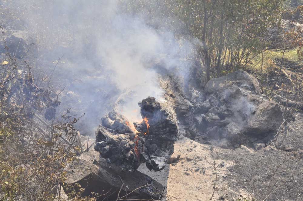
- A tree trunk sits beside the road still aflame due to the Rail Ridge Fire on Sept. 4, 2024.
DAYVILLE — Rain and snow moving into the area should help put a damper on the Rail Ridge Fire, fire managers said in an update on Wednesday, Oct. 16.
Trending
The fire burning south of Dayville is nearing 176,000 acres and remains 89% contained. A total of 576 personnel are assigned to the blaze.
Northwest Complex Incident Command Team 2 assumed command of the fire Tuesday night at 8 p.m. Team 2 is looking forward to working with the local landowners, community, and agency administrators during their two-week assignment on the Rail Ridge Fire, fire officials said.
On Tuesday, most of the fire area was shaded by the smoke inversion until it lifted around 1:30 p.m. This prevented fire activity from increasing throughout the morning and early afternoon.
Trending
Winds flowed into the area from the southwest throughout the morning and shifted to flow from the northwest around 4 p.m. This caused fire activity to increase slightly. However, the northwesterly winds allowed for the fire to push back toward the main fire footprint.
On the northwest section of the fire, crews are continuing to build containment lines above Cougar Ridge. Fire managers are continuing to explore contingency lines farther north of Forest Service Road 3850, which is tied in with dozer lines.
There was a small spot in the northwest that the Salmon River Hotshots quickly addressed and prevented from spreading. Around contained areas of the fire, crews continued suppression repair including extensive hazard tree removal, fence repair, and other cleanup.
Air resources included two Type 1 helicopters and one Type 3 helicopter.
Moderate rains began after midnight. The most active areas of the fire in the Black Canyon Wilderness and Cougar Ridge received up to 0.29 inch of precipitation.
The increased humidity and significant wetting rainfall is expected to curb most of the fire activity that we have been seeing over the last few days, fire officials said. Expect to see on and off mist showers and cloudy skies throughout the day. Winds will pick up from the northwest Wednesday afternoon with gusts up to 25 mph expected on some higher-elevation ridges.
Wednesday, crews in the northwest will continue to use heavy machinery to build containment lines, utilizing Forest Service Road 3850. Firefighters are diligently seeking out hotspots and responding accordingly to changing or unexpected weather conditions.
Crews on the northeast area of the fire are wrapping up suppression repair and will be ready to relocate if additional fire resources are needed on more active fire perimeters.
Firefighters will continue to work extensively on FS Roads 2150 and 24 to remove hazard trees and increase the safety of these roadways. Fire crews will continue to patrol the contained perimeter of the fire. Air resources will continue to be available and utilized.
With the rain comes slick roads, so fire personnel will be assessing the fire conditions and engaging where it is safe to do so.
Much cooler and wetter conditions are expected over the next few days. Temperatures will likely dip below freezing later Wednesday night and snow showers will be possible above 4,500 feet. Winds will be gusty out of the northwest, but with all the moisture this weather system brings, there should be little impacts to the fire. Rainfall amounts through Thursday will likely exceed 0.1 inch, and higher elevations may see a dusting to an inch of snow through Thursday.
The latest information on Forest Service and BLM closures, evacuation notices and fire restrictions for the Rail Ridge Fire area can be found at https://linktr.ee/RailRidgeFire.
Acres: 175,961
Containment: 89%
Detection: 09/02/24
Cause: Lightning
Personnel: 576
Marketplace


-
eEdition

-

-
