Level 3 evacuation warnings reduced for Rail Ridge Fire
Published 3:15 pm Wednesday, September 18, 2024
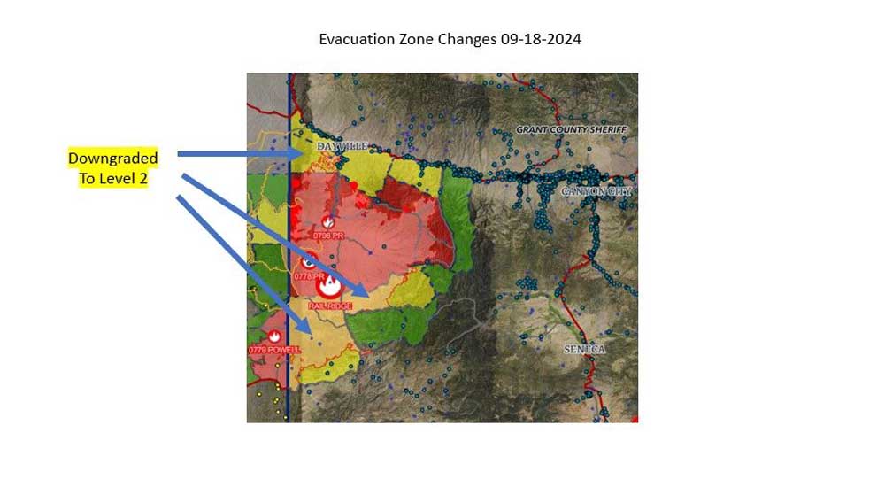
- rail ridge evac map 240918
DAYVILLE — More evacuation zones for the Rail Ridge Fire have been downgraded with the arrival of improved weather conditions, the Grant County Office of Emergency Management announced on Wednesday, Sept. 18.
The following Level 3 “Go Now” evacuation zones have been downgraded to Level 2 “Be Set”:
• The zone south of Cougar Gulch, north of FS Rd 24 and east of South Fork Rd.
• The zone north of the Izee-Paulina Hwy, west of South Fork Rd and east of the county line.
• The zone north of Johnson Creek, west of South Fork Rd and south of Hwy 26.
For regular updates, visit the Grant County Emergency Management Facebook page at https://www.facebook.com/p/Grant-County-Emergency-Management-100068819321423/; call the information line at 541-575-2885; or email the Emergency Operations Center at GCEOC@grantcounty-or.gov.
Access the active GIS map at https://oregon-oem-geo.hub.arcgis.com/