Sand Mountain Fire now 52% contained; Falls, Telephone fires holding
Published 12:19 pm Saturday, August 10, 2024
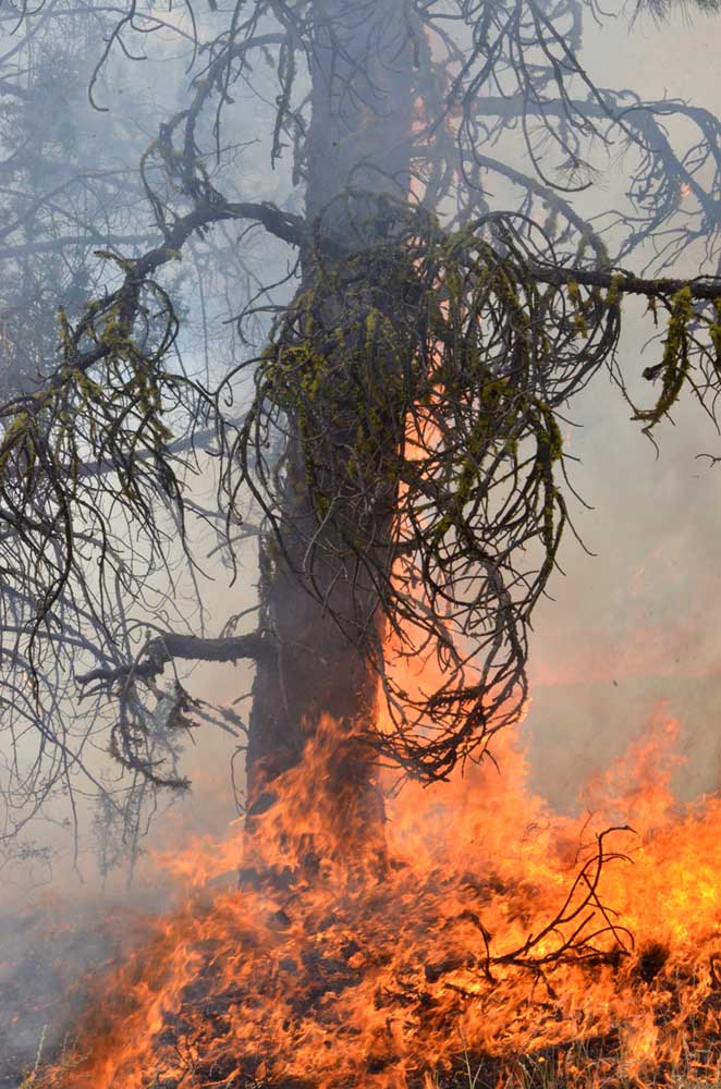
- A tree burns on the northwest edge of the Falls Fire south of Izee on July 16, 2024.
BURNS — Crews have begun to turn the corner on the Sand Mountain Fire, fire managers announced in their daily update on Saturday, Aug. 10.
The fire, burning 17 miles southwest of Seneca, now stands at 7,582 acres and is listed at 52% containment, up from zero containment the day before.
It is one of several major wildfires burning in northern Harney and southern Grant Counties.
The largest of the blazes, the Falls Fire, is an estimated 148,519 acres with 77% containment, whie the second-largest, the Telephone Fire, is an estimated 53,852 acres with 61% containment.
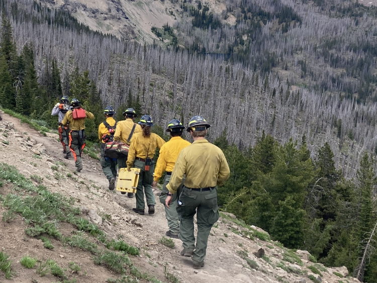
A total of 1,077 firefighters are assigned to the blazes.
Fire managers announced the following priorities for Saturday:
1) Initial Attack (IA); firefighters are ready to respond to any new fire starts.
2) East/northeast portion of Telephone Fire.
3) Northeast side of the Falls/Sand Fire along the 31 Road.
4) West side of the Telephone Fire/King Mountain area.
Fire summaries
Telephone Fire: Although some portions of the Telephone Fire experienced variable winds Friday, crews continued firing operations near the 855 and 2820 Roads on the southwest side of the earlier King Mountain spread. Crews also used UAS for aerial ignition of unburned fuels to increase containment depth and remove fuels that contribute to continued fire activity. A few small pockets of unburned fuel in Perry Meadows generated visible smoke.
On Saturday, crews are focusing on strengthening existing containment lines on the south and east portions of the fire, patrolling the fire perimeter, and extending containment lines to the northwest corner of the Telephone Fire.
Falls/Sand Mountain Fires: On Friday, resources had ongoing success holding the burnout operations that took place over several days on the northeast corner of the Falls and Sand Mountain Fires. In the Gilbert Ridge area, firefighters continued removing hazard trees. Crews also conducted limited burnout operations on the 31 Road while conditions remained favorable.
On Saturday, firefighters will continue felling hazard trees in the 3150/3160/3170 Roads area and conducting firing operations near Crane Flats and the 3170/31 Roads. With the significant progress made over the recent shifts, crews will also focus on deepening containment lines. Given the large perimeter and ongoing critical fire weather, work is expected to be challenging, but crews remain vigilant and committed to deepening containment lines and securing any problem areas.
Weather: Temperatures will moderate slightly, and the fire area saw good humidity recoveries overnight. Light to moderate winds are expected Saturday. There is a low chance of thunderstorms this afternoon and could produce strong outflow winds.
Evacuations: There are no changes to the evacuation orders for Grant and Harney counties. For the most accurate evacuation information, visit the Harney County Sheriff’s evacuation map: https://bit.ly/FallsFireEvac, or the Grant County Emergency Management Facebook page: https://www.facebook.com/profile.php?id=100068819321423
Closures: A closure is in effect for portions of the Malheur National Forest west of 395B, north of Mt. Vernon and south of Long Creek, in the Fox Valley area, including all roads, trails, and camping within the closure area. A map of the closure is available on the Malheur National Forest website (https://www.fs.usda.gov/detail/malheur/news-events/?cid=FSEPRD1198892) and in local U.S. Forest Service offices.
Investigation: The U.S. Forest Service is seeking the public’s assistance with any information pertinent to the start of the Falls Fire on the Malheur National Forest. Submit any relevant information to SM.FS.R6TipHotLine@usda.gov.
Temporary Flight Restriction (TFR): TFRs in the area have been changing; pilots should check the latest information on the Federal Aviation Administration TFR website prior to flying: https://tfr.faa.gov/tfr_map_ims/html/index.html
Facebook: https://www.facebook.com/p/Falls-Fire-2024-61562126623985/
Falls Fire InciWeb: https://inciweb.wildfire.gov/incident-information/ormaf-falls-fire
Telephone Fire InciWeb: https://inciweb.wildfire.gov/incident-information/ormaf-telephone-fire
Fire Information Line: 541-208-4370, staffed 8 a.m. to 8 p.m.
Email: 2024.Falls@firenet.gov
Harney County Non-emergency Evacuation Questions: 541-589-5579
Air Quality Questions: 541-573-2271. Air quality information, searchable by ZIP code: https://fire.airnow.gov/
Smoke Outlooks: https://outlooks.airfire.org/outlook
Size: 53,852
Start Date: July 22, 2024
Location: 12 miles NE of Burns, OR
Containment: 61%
Total Personnel: 570 personnel
Cause: Lightning/Natural
Resources Assigned: 12 hand crews, 22 engines, 4 bulldozers, 15 water tenders, 10 skidders
Size: 148,519
Start Date: July 10, 2024
Location: 13 Miles NW of Burns, OR
Containment: 77%
Total Personnel: 507
Cause: Human-caused, under investigation
Structures Triaged: Residences: 386 / Commercial: 119 / Outbuildings: 760
Resources Assigned: 19 hand crews, 28 engines, 14 bulldozers, 8 water tenders, 4 masticators, 2 skidders
Size: 7,582
Start Date: July 25, 2024
Location: 17 miles SW of Seneca, OR
Containment: 52%
Total Personnel: Staffed by Falls Fire
Cause: Lightning/Natural
Aerial resources assigned: Two Type 1 helicopters / One Type 1 Unmanned Aircraft System (UAS)


-
eEdition

-

-

