UPDATED: John Day River hits flood stage after valley snow melt-off
Published 3:55 pm Monday, January 22, 2024
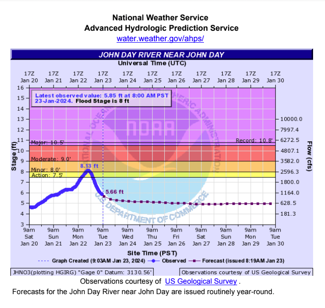
- This government weather chart shows the John Day River hitting flood stage, peaking at 8.13 feet at around 8 p.m. on Monday, Jan. 22, 2024.
JOHN DAY — Several inches of water on a patch of Highway 26 near the Keeney Fork Road junction just west of Prairie City prompted the Oregon Department of Transportation to post warning signs Monday, Jan. 24, as officials kept a close eye on John Day River levels.
Trending
Pastureland in places along the highway between John Day and Prairie City on Monday morning was flooded, with water about a foot deep in parts.
With snow melting off in the John Day Valley, a John Day River level forecast from the National Weather Service on Monday predicted flooding, with a peak of 8.13 feet at about 8 p.m. on Monday night, weather officials said.
Action stage on the river is called by weather officials at 7.5 feet, with 8 feet considered likely to cause minor flooding, according to National Weather Service meteorologist Colby Goatley.
Trending
Goatley said the levels were expected to drop off after peaking on Monday night.
“Anytime you see minor flooding, that generally means some of the low-lying fields will start to see runoff,” he said.
Constant snowfall in the second week of January dropped anywhere from 14 to 20 inches of snow throughout the John Day Valley, according to weather officials, with residents saying they hadn’t seen this much snow in the valley come down this fast in more than 60 years. With temperatures in the 40s through the latter part of last week and the beginning of this week, much of the snow and ice in the lower elevations had melted off lawns, sidewalks and roadway pavement.
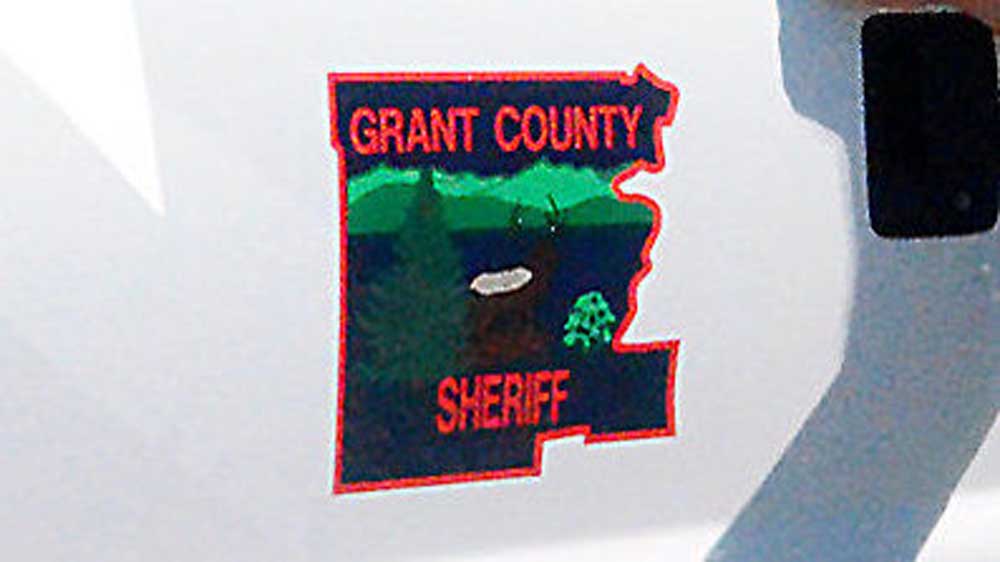
“We’ve seen a real deliberate increase of about 3½ feet in river levels since Saturday afternoon, and the National Weather Service is predicting that we’re at the peak right now, but that’s just a forecast,” said Grant County Emergency Management Coordinator Eric Bush on Monday afternoon. “It could go higher, and we just encourage everyone to keep an eye on their properties and roadways and, if they’re having any difficulties, to let (the Grant County Sheriff’s Office) know if there is anything we can do to help mitigate it.”
On Tuesday morning, Bush said there were no reports of significant damage to property from flooding.
“There was a lot of localized flooding in low-lying areas that typically see standing water when the river gets this high,” he said.
Sheriff Todd McKinley said the past week saw a few vehicle slide-offs but no major injury incidents due to weather conditions on the region’s roadways.
“Dixie (Pass) had a lot of OSP attention from the trucks that were not chained up,” he said. “There were a lot of trucks that hadn’t chained up. That was creating problems. Other than that, there’s just been minor incidents, with snow berms along the road and people not able to get out.”

-
eEdition

-

-
