Cow Fire grows slowly to 9,600 acres Friday morning
Published 10:18 am Friday, September 6, 2019
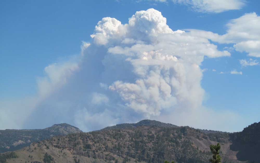
- The Cow Fire seen from 8,000 feet coming down from Strawberry Mountain’s summit Aug. 28.
The Cow Fire continues to creep west, growing to 9,600 acres with 65% containment Friday morning.
Thursday afternoon the fire area received light rainfall, ranging from a trace to as much as several hundredths of an inch, according to a press release. This moisture did not penetrate the forest canopy enough to significantly wet fuels on the ground. Unburned areas within the containment lines will remain susceptible to the fire.
Thursday the fire moved primarily in the upper Swamp Creek drainage and on the unlined western flank, spreading farther west toward and into areas burned by previous wildfires. Sparse fuels limited the fire’s spread on this flank.
On the northern, eastern and southern flanks, the fire has reached the lines identified, built and reinforced over several weeks. Crews continued mopping up areas immediately inside firelines.
This morning brings a chance of showers or thunderstorms, with clearing and a return to lower humidity in the afternoon. Firefighters will check the fire spread and intensity on the uncontained western flank and in upper Swamp Creek as necessary to protect the ridgetop barrier forming the containment line. Crews will continue chipping cleared material along Forest Road 16, and removing hoses and other equipment from the southern flank. The total number of personnel assigned has decreased to 363 as containment objectives are reached.
This remains a full suppression fire, with the objective of stopping the fire where the risk to firefighters is minimized and the probability of success is maximized. The fire’s intensity and rate of spread will be checked where practical to keep the effects within a low to moderate range that preserves the largest, most fire-resilient trees while the fire continues to clean up downed material.
A temporary flight restriction remains in place. The NOTAM is 9/9780. The use of an unmanned aerial system (UAS, or “drone”) within the TFR is prohibited. Any drone incursion will force the grounding of all firefighting aircraft. Forest Road 13 remains closed at the Deardorff Summit, along with Forest Road 16 between the Short Creek Guard Station (13/16 road junction) and the forest road 1665/16 junction.
The North Fork Malheur Campground is closed. A Closure Order is in effect for the vicinity of the Cow Fire and surrounding roads. The Closure Order can be viewed on the Cow Fire InciWeb site at http://inciweb.nwcg.gov/incident/6526. As fire behavior moderates and containment increases, the need for road closures is being reevaluated daily and will be lifted as soon as practical.
The Incident Management Team remains prepared to support initial attack of new fires if requested by local agencies. Firefighting equipment assigned includes five handcrews, nine engines, two dozers, three heavy helicopters, two chippers, one skidder, one feller-buncher, one forwarder and two “skidgens” (skidders with mounted water tanks).


