New road, area closure map released for Rail Fire
Published 8:19 am Thursday, September 1, 2016
- map
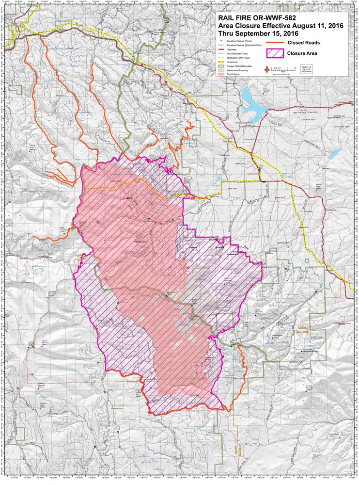
A new road and area closure map has been released for the 70-percent contained, 41,614-acre Rail Fire near Unity.
Areas near the fire remain closed as well as several roads, according to a map provided by the management team.
Forest Roads 2635 and 2640 remain closed from Highway 26 southward to the fire area. Forest Road 16 remains closed between its intersection with Forest Road 13 east to Forest Road 1680. Other roads near the fire remain closed as well.
Winds gusting up to 40 mph produced several spot fires outside containment lines between Table Rock and Bull Run Rock on Wednesday. Ground crews and helicopters arrived quickly to suppress the fire.
Active burning will continue until interior islands of unburned fuel are consumed or there is significant rain. The largest unburned island is roughly 1,000 acres.
There is a 10-percent chance of rain on the northern part of the fire tonight while nighttime temperatures will dip into the low 30s starting Friday night.
Forest Road 13 was reopened Thursday morning, and people with a valid Malheur National Forest firewood permit may collect wood cut and stacked by firefighters along the roadside. Fire restrictions, including chainsaw use prohibition, remain in effect.
The fire is now staffed by 780 people: 17 crews, 17 engines, six dozers, 34 water tenders, one masticator, five skidders and seven helicopters.
For more information call 541-446-3592 or email Railwildfire@gmail.com.


