Crockett Knob Fire update: Aug. 25, 2022
Published 2:43 pm Wednesday, August 24, 2022
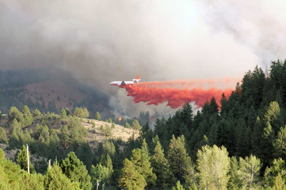
GREENHORN — A fire that broke out roughly 20 miles north of Prairie City on Monday, Aug. 22 after abundant lightning moved through the area has ballooned to 225 acres.
Trending
According to a Thursday, Aug. 25, press release from the U.S. Forest Service, the Crockett Knob Fire is moving primarily south and southwest, burning through timber and brush within the 1996 Summit Fire scar. However, the press release noted that active fire is being observed on all flanks of the blaze.
Access to the fire, Forest Service officials said, is limited due to the steep, rugged terrain.
Fire managers said the blaze was not an immediate threat to any structures and no evacuation orders were in place.
Trending
According to the press release, a total of 140 firefighters are battling back the blaze. Fire engines, hand crews, heavy equipment, helicopters and a fixed-wing aircraft have been deployed. Additionally, Forest Service officials said a falling team had been ordered to help mitigate hazard trees in the area.
Forest Service officials said firefighters are making good progress on the fire along the 45 and 537 roads, removing timber and brush to create a fuel break with the intention of creating containment lines.
The press release noted road, trail, campground and area closures, including portions of Forest Service Road 45 from County Road 20 north to Indian Rock Trailhead and parts of FSR 4550 from FSR 4555 west to the intersection of FSR 45.
Additionally, the Princess Trail is closed from the trailhead to Forest Service Trail No. 251, as is the Big Boulder Trail from the trailhead north to Head O’Boulder Camp.
Also, the Indian Rock Trail is closed from Head O’Boulder Camp north to Sharp Ridge/Squaw Rock trailhead. Head O’Boulder Camp is also closed. An area closure is also in effect from FSR 45 south to FSR 4550, east to FSR 749, north to FSR 436, north to FST No. 251, northwest to FSR 537, then west back to the junction of FSR 45. For complete area closure information and map, visit fs.usda.gov/malheur.
Smoke might be visible to nearby communities and forest visitors. Air quality and smoke can be monitored at oregonsmoke.blogspot.com.
The original version of this story included an incorrect spelling of Crockett Knob. That error has been corrected.
Marketplace


-
eEdition

-

-
