Sand Mountain Fire grows to 7,500 acres in southern Grant County
Published 2:37 pm Wednesday, August 7, 2024
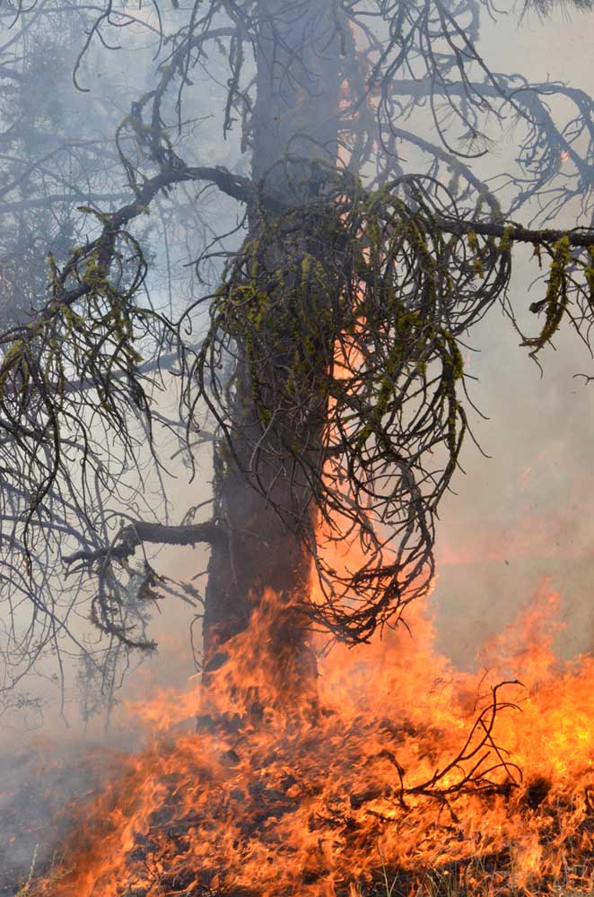
- A tree burns on the northwest edge of the Falls Fire south of Izee on July 16, 2024.
BURNS — The Sand Mountain Fire grew by 1,500 acres on Tuesday, but otherwise firefighters held the line on the cluster of large wildfires burning in northern Harney and Southern Grant counties, fire managers reported in an update on Wednesday, Aug. 7.
Trending
Burning 17 miles southwest of Seneca, the Sand Mountain Fire now covers about 7,500 acres with zero containment. The largest wildfire in the area, the Falls Fire, is an estimated 147,000 acres with 75% containment, while the Telephone Fire stands at about 53,000 acres with 40% containment.
Low relative humidity, surface winds, and unstable air continue to drive the potential for moderate fire activity, fire officials said. These conditions are challenging firefighters working to contain spot fires in some areas and increasing work on hand and dozer lines.
Two Type 1 helicopters and one Type 1 Uncrewed Aircraft System (UAS) are assigned and available to all fires in the area.
Trending
Fire managers listed the following priorities for Wednesday:
1) Initial Attack (IA): The potential for new fire starts remains significant; firefighters are ready to respond to any new threats and remain vigilant and focused on IA.
2) West side of the Telephone Fire/King Mountain area.
3) Northeast side of the Falls/Sand Fire along the 31 road.
4) Northeast side of the Telephone Fire.
Fire Summaries
Telephone Fire: Winds lessened and relative humidities increased slightly Tuesday, but the Telephone Fire remained moderately active and firefighters, including three hotshot crews (Navajo, Wyoming, and Grand Hotshots), worked with dozers to build containment line south of King Mountain back to Trout Creek and 2820 Road.
Initial attack was the highest priority to limit new fire activity and keep the fire west of the 28 Road.
On Wednesday, two divisions on the eastern side of the fire will merge and resources will be adjusted to allow for increased personnel in the west near 600 Road where spotting activity continues.
As our crews work along the 28 road, they are working in close partnership with the Burns Paiute Tribe to reduce the impact to values that are culturally important to the tribe, including using specialized equipment with a lighter footprint as crews prepare shaded fuel breaks. A shaded fuel break is when a majority of, but not all, trees are removed, with 75-foot separation between trees, and surface fuels are removed to the extent possible. These breaks are still aesthetically pleasing but have enough separation to potentially limit extreme fire behavior.
Falls/Sand Mountain Fires: The northern portion of the Falls Fire saw the most fire activity Tuesday. On the northwest and west flanks of the Sand Mountain Fire, firefighters strengthened and improved fireline using crews and heavy equipment to remove fuels. Efforts focused on keeping the fire from moving north toward Izee and protecting private property, range resources and livestock.
Crews working on the northeast focused on installing hose lays in and around spot fires along the 31 Road and completing indirect fireline on the 488 and 31 Roads. Indirect line is line placed away from the fire edge that takes advantage of natural and man-made barriers and allows for burnout operations, which could take place today if needed.
Crews working along the southern and southwestern portions of the Falls Fire will continue monitoring and patrolling but will be assigned to initial attack if needed and will be available to move to other areas or the Telephone fire.
Weather: On Wednesday, slightly cooler temperatures will prevail, but conditions remain dry with terrain-driven winds in the morning. In the afternoon, gusts of 25 mph are possible along with moderate air instability. Looking ahead, conditions are expected to remain seasonably hot and dry with slightly weaker afternoon winds and a slight chance of showers and thunderstorms in the region.
Evacuations: For the most accurate evacuation information, please visit the Harney County Sheriff’s evacuation map here: https://bit.ly/FallsFireEvac, or the Grant County Emergency Management Facebook page: https://www.facebook.com/profile.php?id=100068819321423.
Closures: A closure is in effect for portions of the Malheur National Forest west of 395B, north of Mt. Vernon and south of Long Creek, in the Fox Valley area, including all roads, trails, and camping locations within the fire closure area. Due to control and containment measures portions of the Malheur National Forest previously under the South Area Closure are now reduced. Areas remain closed to protect public health and safety while fire activity and fire suppression operations continue. This Forest Order rescinds and replaces the previous southern area closure (06-04-00-24-17). A detailed map of the closure is included and available on the Malheur National Forest website (https://www.fs.usda.gov/detail/malheur/news-events/?cid=FSEPRD1198892) and in U.S. Forest Service offices.
Investigation: U.S. Forest Service fire investigators are seeking the public’s assistance with any tips or information pertinent to the start of the Falls Fire on the Malheur National Forest. Please submit any information that could assist fire investigation efforts to SM.FS.R6TipHotLine@usda.gov.
Temporary Flight Restriction (TFR): TFRs in the area have been changing; pilots should check the latest information on the Federal Aviation Administration TFR website prior to flying: https://tfr.faa.gov/tfr_map_ims/html/index.html
Facebook: https://www.facebook.com/p/Falls-Fire-2024-61562126623985/
Falls Fire InciWeb: https://inciweb.wildfire.gov/incident-information/ormaf-falls-fire
Telephone Fire InciWeb: https://inciweb.wildfire.gov/incident-information/ormaf-telephone-fire
Fire Information Line: 541-208-4370, staffed 8 a.m. to 8 p.m.
Email: 2024.Falls@firenet.gov
Harney County Non-emergency Evacuation Questions: 541-589-5579
Air Quality Questions: 541-573-2271. Air quality information, searchable by ZIP code: https://fire.airnow.gov/
Smoke Outlooks
Size: 53,388
Start Date: July 22, 2024
Location: 12 miles NE of Burns, OR
Containment: 40%
Total Personnel: 484 personnel
Cause: Lightning/Natural
Resources Assigned: 14 hand crews, 4 engines, 2 bulldozers, 2 skidders
Size: 147,320
Start Date: July 10, 2024
Location: 13 Miles NW of Burns, OR
Containment: 75%
Total Personnel: 554
Cause: Human-caused, under investigation
Structures Triaged: Residences: 386 / Commercial: 119 / Outbuildings: 760
Resources Assigned: 23 hand crews, 40 engines, 17 bulldozers, 24 water tenders, 6 masticators, 8 skidders
Size: 7,465
Start Date: July 25, 2024
Location: 17 miles SW of Seneca, OR
Containment: 0%
Total Personnel: Staffed by Falls Fire
Cause: Lightning/Natural
Whiskey Mountain: 4,345 acres
Cow Creek: 86 acres
Parasol: 485 acres
Poison: 1,059 acres
Ritter: 461
Total Personnel: Staffed by Falls Fire
Marketplace


-
eEdition

-

-
