Firefighters hold lines on Falls, Sand, Telephone fires
Published 11:18 am Friday, August 9, 2024
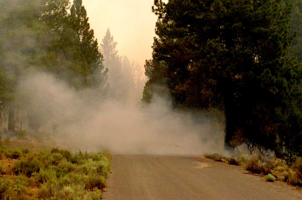
- Smoke obscures the view where the Falls Fire crossed Forest Service Road 31 on July 16, 2024.
BURNS — Firefighters consolidated gains and held established containment lines on the cluster of wildfires burning in northern Harney and Southern Grant counties, fire managers said in an update on Friday, Aug. 9.
Trending
The Falls Fire continues to hold at about 148,000 acres and is now 77% contained. The Telephone Fire is an estimated 54,000 acres with 59% containment, and the Sand Mountain Fire is holding at 7,500 acres with zero containment. A total of 1,077 personnel are assigned to the fires in the area.
Fire managers set the following priorities for Friday:
1) Initial Attack (IA): The potential for new fire starts remains significant; firefighters are ready to respond to any new threats and remain vigilant and focused on IA.
Trending
2) West side of the Telephone Fire/King Mountain area.
3) East/northeast portion of Telephone Fire.
4) Northeast side of the Falls/Sand Fire along the 31 Road.
Fire Summaries
Low relative humidity, some surface winds, and slightly unstable air have the potential for moderate fire activity. These conditions can be challenging for firefighters working to deepen containment lines, officials said.
Two Type 1 helicopters and one Type 1 Uncrewed Aircraft System (UAS) are assigned and available to all fires in the area.
Telephone Fire: The Telephone Fire remained moderately active despite lighter winds. On Thursday, the work of both the day and night shifts again resulted in increased containment depth and blackline. Crews continued working to build line in the area of 2830 and 28 Roads as contingency for a future fuel break. Firefighters are making progress and crews are also holding the containment lines in the area of the recent spread on King Mountain.
On Friday, resources on the northeastern portion of the fire will be in patrol status, monitoring the area and checking for spots. Day shift crews will be holding the progress made overnight by crews conducting limited burnout operations. Given the large perimeter and ongoing critical fire weather, work is expected to be challenging, but crews remain vigilant and committed to deepening containment lines and securing any problem areas.
Falls/Sand Mountain Fires: On Friday, resources had continued success holding the burnout operations that took place through the evening hours on the northeast corner of the Falls and Sand Mountain Fires. At least five more days of limited burning is expected to tie the Sand Mountain Fire back into the north end of the Falls Fire.
In the Gilbert Ridge area, firefighters are removing hazard trees called snags along the road system to improve safety. Snags are dead, standing trees in the fire area without leaves or needles in the crowns. These trees are a significant hazard to wildland firefighters because they have lower fuel moistures than live trees and burn more readily.
Crews conducted limited burn out operations on the 31 Road while conditions remained favorable. A burnout operation removes unburned fuel between the containment line and the fire edge to reduce the potential for further fire activity. Burning out also allows better control over the intensity of the fire against the containment line.
With the significant progress made over the recent shifts, crews will also focus on deepening containment lines. As before, initial attack remains the highest priority to limit new fire activity.
Weather: Temperatures will remain seasonably hot and dry with morning winds giving way to light northwest winds on Friday afternoon. There is a chance of thunderstorms that could produce gusty outflow winds. High temperatures, continued low relative humidities, winds, and unstable air are the primary weather drivers of the fire. Friday’s weather conditions are supportive of large fire growth.
Evacuations: The Harney County Sheriff’s Office again lowered evacuation levels for the Falls and Telephone Fires 2024 due to the increasing containment of the fires.
Downgrading from Level 2 to Level 1 (Be Ready): Zones 025A, 025C, 049B and 049C: From the Grant/Harney County line, east of the Telephone Fire that includes Pine Creek Road down to Highway 20.
Downgrading to No Level: Zone 25B: South from the Grant/Harney County line, east of the 15 Road to where Hog Flat meets the Malheur River, and south to Zone 049C.
For the most accurate evacuation information, please visit the Harney County Sheriff’s evacuation map here: https://bit.ly/FallsFireEvac, or the Grant County Emergency Management Facebook page: https://www.facebook.com/profile.php?id=100068819321423.
Closures: A closure is in effect for portions of the Malheur National Forest west of 395B, north of Mt. Vernon and south of Long Creek, in the Fox Valley area, including all roads, trails, and camping locations within the fire closure area. Due to control and containment measures portions of the Malheur National Forest previously under the South Area Closure are now reduced. A detailed map of the closure is available on the Malheur National Forest website (https://www.fs.usda.gov/detail/malheur/news-events/?cid=FSEPRD1198892) and local in U.S. Forest Service offices.
Investigation: U.S. Forest Service fire investigators are seeking the public’s assistance with any tips or information pertinent to the start of the Falls Fire on the Malheur National Forest. Please submit any information that could assist fire investigation efforts to SM.FS.R6TipHotLine@usda.gov.
Temporary Flight Restriction (TFR): TFRs in the area have been changing; pilots should check the latest information on the Federal Aviation Administration TFR website prior to flying: https://tfr.faa.gov/tfr_map_ims/html/index.html
Facebook: https://www.facebook.com/p/Falls-Fire-2024-61562126623985/
Falls Fire InciWeb: https://inciweb.wildfire.gov/incident-information/ormaf-falls-fire
Telephone Fire InciWeb: https://inciweb.wildfire.gov/incident-information/ormaf-telephone-fire
Fire Information Line: 541-208-4370, staffed 8 a.m. to 8 p.m.
Email: 2024.Falls@firenet.gov
Harney County Non-emergency Evacuation Questions: 541-589-5579
Air Quality Questions: 541-573-2271. Air quality information, searchable by ZIP code: https://fire.airnow.gov/
Smoke Outlooks: https://outlooks.airfire.org/outlook
Size: 53,765
Start Date: July 22, 2024
Location: 12 miles NE of Burns, OR
Containment: 59%
Total Personnel: 570
Cause: Lightning/Natural
Resources Assigned: 12 hand crews, 22 engines, 4 bulldozers, 15 water tenders, 10 skidders
Size: 147,789
Start Date: July 10, 2024
Location: 13 Miles NW of Burns, OR
Containment: 77%
Total Personnel: 507
Cause: Human-caused, under investigation
Structures Triaged: Residences: 386 / Commercial: 119 / Outbuildings: 760
Resources Assigned: 19 hand crews, 28 engines, 14 bulldozers, 8 water tenders, 4 masticators, 2 skidders
Size: 7,542
Start Date: July 25, 2024
Location: 17 miles SW of Seneca, OR
Containment: 0%
Total Personnel: Staffed by Falls Fire
Cause: Lightning/Natural
Whiskey Mountain: 4,345 acres
Cow Creek: 86 acres
Parasol: 485 acres
Poison: 1,060 acres
Ritter: 461
Total Personnel: Staffed by Falls Fire
Marketplace


-
eEdition

-

-
