Weather aids fight against Lone Rock Fire
Published 3:28 pm Tuesday, July 30, 2024
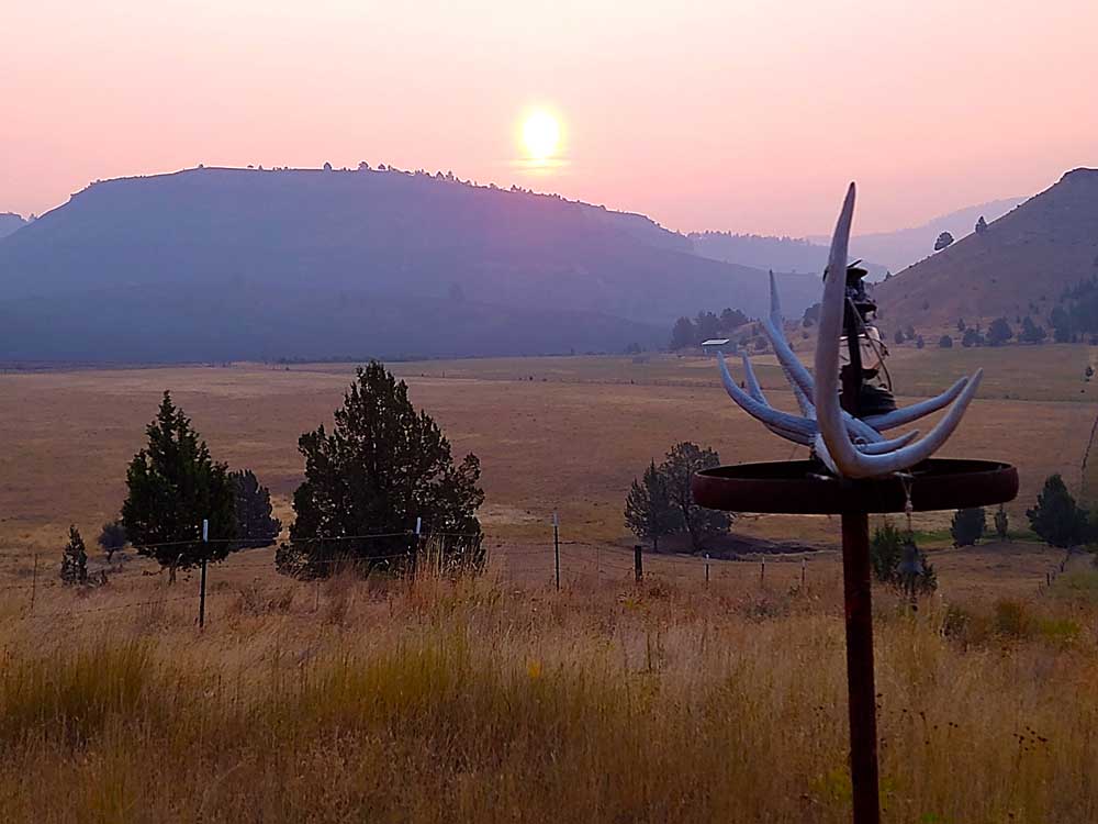
- Smoke from the Lone Rock Fire hazes the skies near Spray on July 28, 2024.
CONDON — Aided by favorable weather conditions, firefighters continued to make progress on mopping up the Lone Rock Fire, fire managers announced in their daily update for Tuesday, July 30.
Trending
Burning from Lonerock south toward Spray and Service Creek, the Lone Rock Fire is estimated at 137,000 acres and 77% containment. A total of 633 firefighters are assigned to the blaze.
The Lone Rock Fire is being managed under a full suppression strategy by Northwest Incident Management Team 2 (NW2).
The rain and lower temperatures provided favorable conditions for firefighters working the line Monday, with some areas receiving up to 0.25 inch of rain. Firefighters continued mop-up operations on the east side of the fire between Forest Service Road (FSR) 21 and FSR 25.
Trending
Work around the slopover near Notch Road has been greatly successful, allowing the area to be transitioned to a patrol status. Firefighters patrolling the north end of the fire, OR-19, and Alder Creek Road had no issues to report, and received no calls from residents reporting smoke or fire concerns.
Tuesday is the last shift for Northwest Incident Management Team 2. Southwest Area Incident Management Team 2 will assume command of the incident starting at 6 a.m. Wednesday. NW2 team members will be briefing the Southwest team about the current situation of the incident and getting them set up for a successful transfer of command.
The operational focus Tuesday will remain the same as Monday, patrolling containment lines and continuing to mop-up areas that show signs of residual heat. Clean up work will also continue along FSR 25, OR-19, and Lonerock Road.
Evacuations:
There are no Level 3 evacuations in place for the Lone Rock Fire.
For Gilliam County evacuation information, visit Gilliam County Sheriff’s Office Facebook page.
For Wheeler County evacuation information, visit Wheeler County Sheriff’s Office Facebook page.
For Morrow County evacuation information, visit Morrow County Sheriff’s Office Facebook page.
Closures:
• For updated road closure information, visit https://www.tripcheck.com/.
Umatilla National Forest Order Number 06-14-02-24-02 includes prohibitions within the Heppner Ranger District on the Umatilla National Forest.
Bureau of Land Management (BLM) Prineville District Office issued an Emergency Public Land Closure on BLM-managed lands along the main stem John Day River and along the North Fork John Day River from Kimberly, Ore. to Dale, Ore.
Weather: Tuesday will be cool with highs in the mid 70s to mid 80s. Excellent relative humidity recoveries overnight will result in relative humidity values between the high 30s to low 40s. Winds are expected to be light and terrain driven.
Smoke Information: Visit https://fire.airnow.gov/ for local air quality information.
Flight Restrictions: A Temporary Flight Restriction (TFR) is in place above the Lone Rock Fire area.
Location: Lonerock, Ore. to west of Highway 207
Size: 137,221 acres
Containment: 77%
Cause: Under Investigation
Start Date: July 13, 2024
Total Personnel: 633
InciWeb: https://inciweb.wildfire.gov/incident-information/orprd-lone-rock-fire
Fire Information Line: 541-208-4369
Marketplace


-
eEdition

-

-
