National Guard joins crews fighting Falls and Telephone fires
Published 2:35 pm Thursday, August 1, 2024
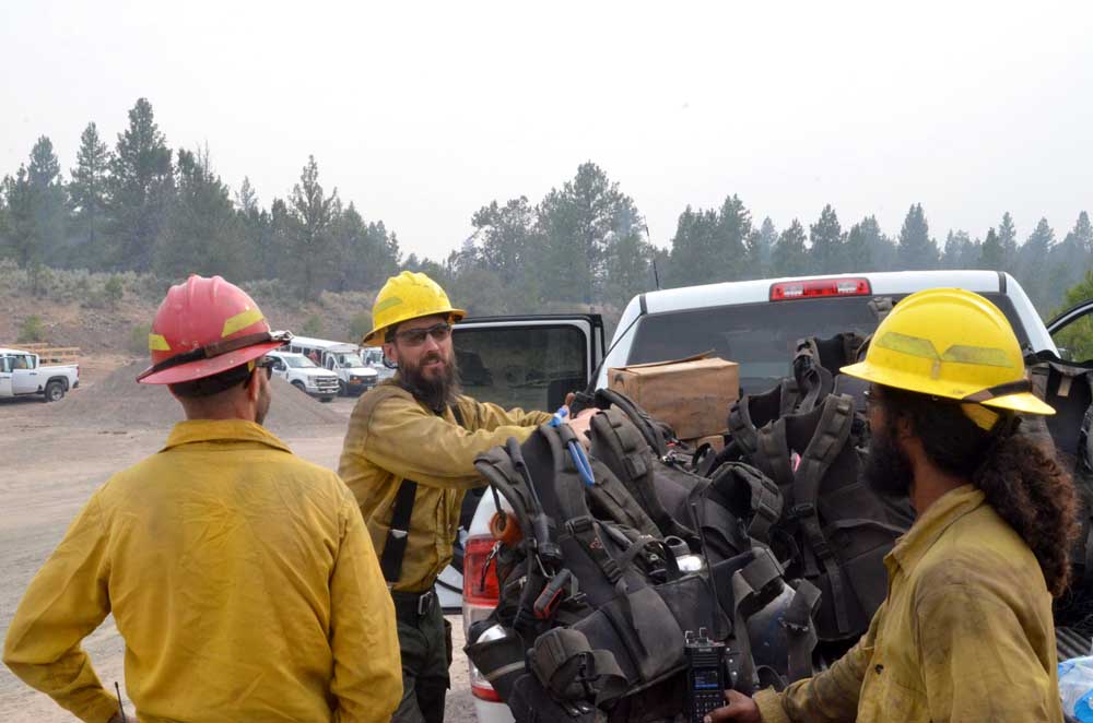
- Contract firefighters with Dust Busters Plus from Eugene wait for the night shift to relieve them on July 16, 2024.
BURNS — The National Guard has joined the fight against the wildfires burning in southern Grant and northern Harney counties, fire managers announced Thursday, Aug. 1, in their daily update on the Falls Fire and related incidents.
Trending
Four hand crews have been assigned to the team managing the Falls Fire, Telephone Fire and other blazes in the area, according to information from the Oregon Department of Forestry.
The deployment totals 92 personnel: 22 firefighters per crew, plus two liaisons and two support personnel. Two of the crews will be staffed by Air Guard members, and two will be staffed with Army Guard members.
“This year’s extreme weather has tested our limits, but our unwavering commitment to protecting Oregon’s communities and natural resources remains, ODF Deputy Director of Fire Operations Kyle Williams said. “We are leveraging every resource available to fight the wildfires, including our partners at the Oregon National Guard.”
Trending
The service members were placed on state active duty orders and then assigned to the fire through ODF. Their assignment will last 14 days in support of the U.S. Forest Service on multijurisdictional fires.
“The Oregon Guard is engaged and supporting first responders to what is shaping up to be another busy fire season,” said Lt. Col. Stephen Bomar, director of public affairs for the Oregon Military Department. “We are prepared to continue support as requested to assist our fellow Oregonians as needed.”
With the potential for new fire starts in the area remaining significant at this time, firefighters would remain focused on initial attack and ready to respond to any new threats on Thursday, fire managers said.
Other top priorities for Thursday include:
• Continue tying into the Pine Creek Fire footprint to secure the northeast portion of the Telephone Fire.
• Continue to hold and improve existing line on the southwest side of Telephone Fire.
• Continue to secure line on the Poison Fire.
• Hold and conduct mop of on the northwest side of Falls Fire.
Hotter and drier weather occurring over the next several days could lead to increased fire behavior and will test existing firelines, officials said. Critical areas will be reinforced with additional resources throughout the fire footprint.
Telephone Fire: Overall, very good progress is being made on the Telephone Fire. The southwest side is in hold and patrol status with no fire growth, and some resources from this area will begin transferring to the east side of the fire. Crews are working to hold and secure the Rattlesnake area. On Wednesday, small-scale firing operations were completed around Poujade, and crews will continue to secure this area today. There has been huge success in continued work from both the north and the south to create line to tie into the Upper Pine Fire footprint and secure the area.
Thursday, crews will monitor and patrol ignition areas along the eastern side, continue to secure the area into Pine Creek, and use aggressive direct and indirect tactics to keep the fire footprint as small as possible. A task force of engines from the BLM Burns District as well as reinforcement from Oregon National Guard crews will be working on the east side of the Telephone Fire today.
Falls Fire: The southern portion of the fire continues to look good, as well as the north portion in the direction of Izee, which hasn’t moved in the last two days. Large machinery is in use on the north side of the fire, to improve line. As of Wednesday, crews had now done mop up 25 feet into the containment line of the Whiskey Mountain Fire and will work on increasing depth on Thursday to move towards monitor status for the area. Crews are making fast progress on a fuel break along the 31 road and are aiming to connect into the Sand Fire footprint in this area. South of Myrtle Creek, crews are doing mop up and working on contingency lines; and line constructed around a recent slopover is holding well. Line is fully complete around the northeast corner of the Falls fire, designed to protect Seneca, Silvies Ranch, and the 395 corridor.
Sand Mountain Fire: Firefighters continued to improve line around Smokey Creek on the northwest side of the fire; work also continued to build dozer line around the 31 road to use as indirect line. Crews continued to secure this line on Wednesday.
Thursday, crews will strengthen and improve fire line along the north and west flanks of the fire, patrol, and mop up.
Parasol and Poison Fires: The Parasol is completely surrounded with line, and is now in monitor status, with light engine presence. Crews have been doing mop up and reinforcing, and this fire is gradually being de-staffed so resources can work on other areas. On the Poison Fire, crews conducted small-scale firing operations along the northeast corner and completed tying line into the road system. Thursday they will continue to secure line, mopping and gridding.
Ritter Fire: 100% containment has been reached on the fire. Crews are doing final gridding and anticipate the Ritter Fire will go into monitor status Thursday.
Aerial resources assigned: 2 Type 1 helicopters assigned and available to all fires in the area. One Type 1 Uncrewed Aircraft System (UAS) is available to all fires in the area. This UAS can fly over fires and livestream imagery back to operations personnel. UAS uses infrared sensors to detect spot fires, even in smoky conditions, during the day when other aircraft can’t fly. At night they are also used to assist firefighters by providing surveillance and scanning for spot fires outside the fire line, then guiding crews to those fires to extinguish them.
Additional resources: An Incident RAWS, a remote, autonomous, portable weather station, has been deployed to Pine Creek Meadow. RAWS are weather stations, strategically placed in remote locations, which measure wind speed and direction, air temperature, precipitation, relative humidity, solar radiation and fuel moisture to keep fire personnel informed of the latest conditions.
Weather: High pressure is building over the region which will bring a warming and drying trend. Further strengthening of the high pressure will cause dangerous heat to impact the region Thursday through Saturday, with a fire weather watch for Friday. Smoke from the Park Fire in Northern California is expected to sit over our area today.
Evacuations: Several areas in northern fire zones dropped from Level 3 to Level 2 evacuation status, while evacuation orders were totally lifted in one area of southern Grant County previously at Level 1.
Due to the continued growth east of the Telephone Fire, evacuations have expanded. For the most accurate evacuation information, please visit the Harney County Sheriff’s evacuation map here: https://tinyurl.com/3zst4sjy, or the Grant County Emergency Management Facebook page: https://www.facebook.com/profile.php?id=100068819321423.
Closures: Due to active wildfires compounded by extremely unfavorable weather conditions, limited firefighting resources and County Resources, Malheur National Forest officials have temporarily closed lands within the Malheur National Forest.
Investigation: U.S. Forest Service fire investigators are seeking the public’s assistance with any tips or information pertinent to the start of the Falls Fire on the Malheur National Forest. Please submit any information that could assist fire investigation efforts to SM.FS.R6TipHotLine@usda.gov.
Temporary Flight Restriction (TFR): TFRs in the area have been changing; pilots should check the latest information on the Federal Aviation Administration TFR website prior to flying: https://tfr.faa.gov/tfr_map_ims/html/index.html
Facebook: https://www.facebook.com/p/Falls-Fire-2024-61562126623985/
Falls Fire InciWeb: https://inciweb.wildfire.gov/incident-information/ormaf-falls-fire
Telephone Fire InciWeb: https://inciweb.wildfire.gov/incident-information/ormaf-telephone-fire
Fire Information Line: 541-208-4370, staffed 8 a.m. to 8 p.m.
Email: 2024.Falls@firenet.gov
Harney County non-emergency evacuation questions: 541-589-5579
Air quality questions: 541-573-2271. Air quality information, searchable by ZIP code: https://fire.airnow.gov/
Size: 38,726
Start Date: July 22, 2024
Location: 12 miles NE of Burns, OR
Containment: 23%.
Total Personnel: 236 personnel
Cause: Lightning/Natural
Resources Assigned: 8 hand crews, 15 engines, 6 bulldozers, 6 water tenders, 2 skidders
Size: 143,236
Start Date: July 10, 2024
Location: 13 Miles NW of Burns, OR
Containment: 73%
Total Personnel: 1,058
Cause: Human-caused, under investigation
Structures Triaged: Residences: 386; Commercial: 119 Outbuildings: 760
Resources Assigned: 30 hand crews, 48 engines, 13 bulldozers, 24 water tenders, 7 masticators, 8 skidders
Size: 4,974
Start Date: July 25, 2024
Location: 17 miles SW of Seneca, OR
Containment: 0%
Total Personnel: Staffed by Falls Fire personnel
Cause: Lightning/Natural
Size: 459
Start Date: July 23, 2024
Location: Stinking Water Mountain NE of Crane, OR
Containment: 100%.
Total Personnel: 17 personnel
Cause: Lightning/Natural
Whiskey Mountain: 4,292 acres
Cow Creek: 86 acres
Parasol: 485 acres
Poison: 1,000 acres
Total Personnel: Staffed by Falls Fire personnel
Marketplace


-
eEdition

-

-
