Delintment Lake reopens as Malheur Forest closure is reduced
Published 8:29 am Tuesday, August 13, 2024
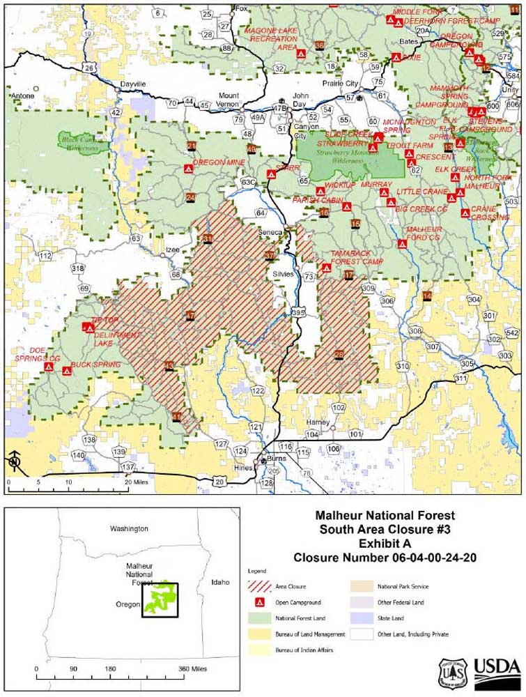
- malheur closure map 240813
JOHN DAY — The Malheur National Forest has reduced a closure in the vicinity of the Falls Fire, reopening the area west of Forest Service Road 4100, including Delintment Lake and campground.
Trending
The reduced closure area is effective Tuesday, Aug. 13, forest officials announced.
However, other parts of South Area Closure No. 2 will remain in effect due to fire activity and fire suppression operations.
This Forest Order rescinds and replaces the previous southern area closure No. 2 (06-04-00-24-19), officials said.
Trending
The following areas are still closed under the revised order:
• Grant County Road 63 following the National Forest boundary to Highway 395, south of Seneca.
• Highway 395 south of Seneca following the National Forest boundary to Forest Service Road 1600 to Forest Service Road 1601.
• Following Forest Service Road 1601 southeast to the intersection of Forest Service Road 1700.
• Following Forest Service Road 1700 to the intersection of Forest Service Road 1500.
• Following Forest Service Road 1500 to the Malheur National Forest Service boundary.
• Following the southern portion of the Emigrant Creek Ranger District around to Forest Service Road 4100.
• Following Forest Service Road 4100 to the National Forest boundary.
• Following the National Forest boundary to Grant County Road 63.
Marketplace


-
eEdition

-

-
