Sand Mountain Fire is now fully contained; lines holding on Falls, Telephone fires
Published 12:40 pm Wednesday, August 14, 2024
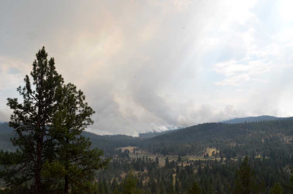
- On July 16, 2024, the Falls Fire had not yet spread into Grant County.
BURNS — The Sand Mountain Fire is now fully contained while containment crept up slightly on the other two major wildfires burning in northern Harney and southern Grant counties, fire managers reported in an update on Wednesday, Aug. 14.
Trending
The 7,600-acre Sand Mountain Fire, burning 17 miles southwest of Seneca, is now 100% contained, fire officials said.
The Telephone Fire, 12 miles northeast of Burns, is holding at 54,000 acres and is now 65% contained, up from 64% on Tuesday. And the Falls Fire, 13 miles northwest of Burns, is now just under 152,000 acres and is 89% contained, up from 87% the day before.
A total of 1,051 personnel are assigned to fight the cluster of wildfires in the area. Available resources include 28 hand crews, 36 engines, 11 bulldozers, 31 water tenders, 1 masticator, 12 skidgines, one Type 1 helicopter.
Trending
Fire managers listed the following priorities for Wednesday:
1) Initial Attack (IA) is the highest priority to keep all new fires as small as possible.
2) Northeast portion of the Falls Fire; increasing mop-up depth and spot containment.
3) Northwest portion of the Telephone Fire near Gobbler’s Knob and King Mountain; increasing mop-up depth and spot containment.
Telephone Fire: Tuesday, work to construct a shaded fuel break on the 2830 and 28 Roads neared completion. Firefighters in the southwest and west cleaned up pockets and conducted burn operations to remove unburned fuels that contribute to continued fire activity.
On Wednesday, the eastern side of the fire will be monitored and patrolled. Additionally, ranchers, firefighters and cooperators will be working together to drive cattle across Highway 395 to safer, unburned areas for grazing. Mastication on the 2830 Road continues along with work on the 28 Road shaded fuel break.
Falls/Sand Mountain Fires: On Tuesday, crews worked on backhaul on the west side of the fire. Backhaul — the process of returning equipment and supplies on a wildfire to a central point for redistribution — is an essential part of wildfire logistics and ensures that resources are efficiently managed and available for changing fire conditions or future incidents.
On Wednesday, firefighters in the northeast will focus on securing the fire’s edge through burning out small pockets of unburned fuels using an unmanned aerial system in the Five Hundred Flat Area. Crews will continue felling operations to remove hazardous trees on the 37 Road. With increased containment across the fire, more of the perimeter is in patrol and monitor status.
Weather: Temperatures are expected to be seasonable with relative humidities in the low teens. Winds will be breezy and light out of the west-southwest. Late Wednesday evening, there is a chance of thunderstorms with abundant lightning and possible gusty outflow winds.
Evacuations: There were changes Tuesday to the evacuation orders for Grant and Harney Counties. For the most accurate evacuation information, visit the Harney County Sheriff’s evacuation map: https://bit.ly/FallsFireEvac, or the Grant County Emergency Management Facebook page: https://www.facebook.com/profile.php?id=100068819321423
Closures: The Malheur National Forest has reduced the South Area Closure. However, to continue protecting public health and safety, fire managers will maintain a portion of the southern part of the forest under closure due to fire activity and fire suppression operations. This Forest Order rescinds and replaces the previous southern area closure. A closure map and the closure order are available on the Malheur National Forest website (https://www.fs.usda.gov/detail/malheur/news-events/?cid=FSEPRD1198892) and in local U.S. Forest Service offices.
Investigation: The U.S. Forest Service is seeking the public’s assistance with any information pertinent to the start of the Falls Fire on the Malheur National Forest. Submit any relevant information to SM.FS.R6TipHotLine@usda.gov.
Temporary Flight Restriction (TFR): TFRs in the area have been changing; pilots should check the latest information on the Federal Aviation Administration TFR website prior to flying: https://tfr.faa.gov/tfr_map_ims/html/index.html
Facebook: https://www.facebook.com/p/Falls-Fire-2024-61562126623985/
Falls Fire InciWeb: https://inciweb.wildfire.gov/incident-information/ormaf-falls-fire
Telephone Fire InciWeb: https://inciweb.wildfire.gov/incident-information/ormaf-telephone-fire
Fire Information Line: 541-208-4370, staffed 8 a.m. to 8 p.m.
Email: 2024.Falls@firenet.gov
Harney County Non-emergency Evacuation Questions: 541-589-5579
Air Quality Questions: 541-573-2271. Air quality information, searchable by ZIP code: https://fire.airnow.gov/
Smoke Outlooks: https://outlooks.airfire.org/outlook
Size: 53,999
Start Date: July 22, 2024
Location: 12 miles NE of Burns, OR
Containment: 65%
Cause: Lightning/Natural
Size: 151,666
Start Date: July 10, 2024
Location: 13 miles NW of Burns, OR
Containment: 89%
Cause: Human-caused, under investigation
Structures Triaged: Residences: 386 / Commercial: 119 / Outbuildings: 760
Size: 7,582
Start Date: July 25, 2024
Location: 17 miles SW of Seneca, OR
Containment: 100%
Cause: Lightning/Natural
Marketplace


-
eEdition

-

-
