Rain aids crews fighting Falls and Telephone fires
Published 8:43 am Friday, August 16, 2024
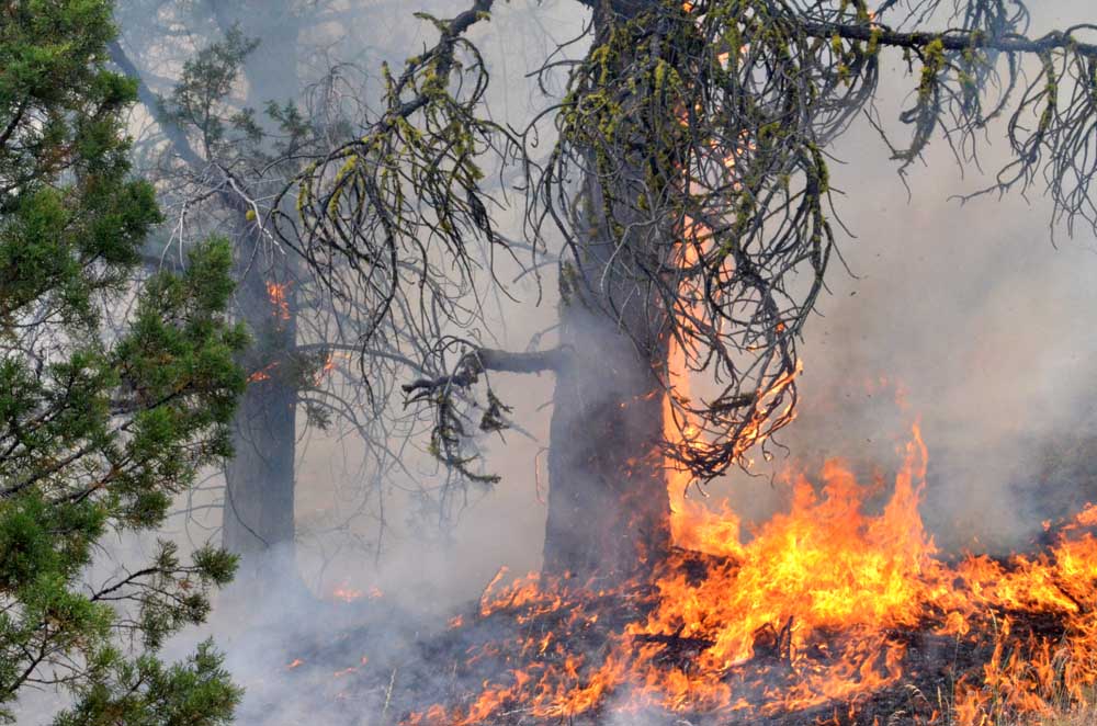
- Flames claim a tree on the Falls Fire's leading edge on July 16, 2024.
BURNS — Aided by rain and cooler temperatures, firefighters on the Telephone and Falls fires focused on mop-up work and staging equipment, fire managers reported in an update on Friday, Aug. 16.
Trending
The Telephone Fire, burning 12 miles northeast of Burns, is holding at 54,000 acres and 95% containment. The Falls Fire, 13 miles northwest of Burns, is 152,000 acres and 89% contained. And the Sand Mountain Fire, 17 miles southwest of Seneca, is 100% contained at 7,600 acres.
On Thursday, crews monitored and patrolled the Telephone Fire, focusing on backhauling equipment and supplies back to camp where it will be prepared to support other fires.
Mastication continued on the 2830 Road near the Little Black Rock area.
Trending
On the Falls Fire, in addition to monitor and patrol, crews used road graders to repair sections of the 43 and 41 Roads in the Parker Creek and Spring Canyon areas.
Friday, crews will remain focused on remaining prepared for initial attack and increasing mop-up depth on the northeast portion of the Falls Fire and the northwest portion of the Telephone Fire. Backhaul will continue on both fires.
Thursday afternoon’s thunderstorms dropped additional wetting rains on the fires, especially parts of the Falls Fire, which received up to ¾ of an inch. Friday’s temperatures are expected to be in the 70s with moderate winds out of the southwest. Looking ahead, conditions on Saturday will begin a warming and drying trend and sustained south winds will be strong, favoring fire activity.
Evacuations: For up-to-date information, visit the Harney County Sheriff’s evacuation map: https://bit.ly/FallsFireEvac, or the Grant County Emergency Management Facebook page: https://www.facebook.com/profile.php?id=100068819321423
Closures: A closure is in effect for the southern area of the Malheur National Forest. A closure map is available on the Malheur National Forest website (https://www.fs.usda.gov/detail/malheur/news-events/?cid=FSEPRD1198892).
Temporary Flight Restriction (TFR): TFRs in the area have been changing; pilots should check the latest information on the Federal Aviation Administration TFR website prior to flying: https://tfr.faa.gov/tfr_map_ims/html/index.html
Facebook: https://www.facebook.com/p/Falls-Fire-2024-61562126623985/
Falls Fire InciWeb: https://inciweb.wildfire.gov/incident-information/ormaf-falls-fire
Telephone Fire InciWeb: https://inciweb.wildfire.gov/incident-information/ormaf-telephone-fire
Fire Information Line: 541-208-4370, staffed 8 a.m. to 8 p.m.
Email: 2024.Falls@firenet.gov
Harney County Non-emergency Evacuation Questions: 541-589-5579
Air quality: https://fire.airnow.gov/
Smoke Outlooks: https://outlooks.airfire.org/outlook
Containment 95%
Size: 54,034 acres
Start Date: July 22, 2024
Location: 12 miles NE of Burns, OR
Cause: Lightning/Natural
Containment 89%
Size: 151,680 acres
Start Date: July 10, 2024
Location: 13 miles NW of Burns, OR
Cause: Human-caused
Marketplace


-
eEdition

-

-
