New evacuation notices issued for fast-growing fires south of Dayville; South Fork Road closed
Published 12:04 pm Tuesday, September 3, 2024

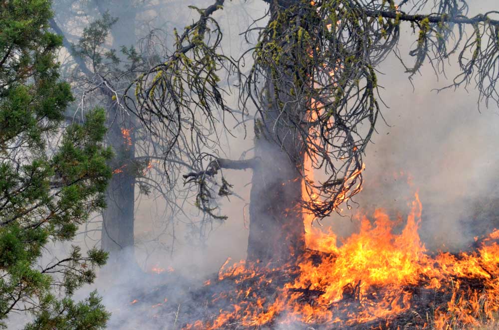
- Flames claim a tree on the Falls Fire's leading edge on July 16, 2024.
DAYVILLE — Evacuation zones continue to expand in the face of new and rapidly growing fires south of Dayville in southwestern Grant County, and the South Fork Road is now closed to all but local traffic and emergency vehicles.
Trending
A Level 3 “Go Now” evacuation advisory was issued Tuesday, Sept. 3, for the southern part of the fire zone west of South Fork Road to the Crook County line and south to the Izee-Paulina Highway by the Grant County Emergency Management Office.
A previous Level 3 evacuation notice remains in effect for the Murderers Creek Ranch and the area south of Murderers Creek to Cougar Creek Gulch and east to Shake Table.
A Level 2 “Be Set” alert that was previously issued for the area south of Wickiup Creek in the north to Fields Creek in the east, Murderers Creek in the south and west to Shake Table has also been extended. It now includes everything north of Forest Service Road 6370 and FSR 24 and the area east to FSR 21.
Trending
A new Level 1 “Be Ready” evacuation notice has been issued on the south side of the fire zone, from the Crook County line north of Swamp Creek Lane and south of the Izee-Paulina Highway and running northeast to FSR 24.
That joins a previous Level 1 advisory on the north side of the fire zone, which runs north to Highway 26, including Dayville, east to Fields Creek and south to Wickiup Creek.
The initial advisories came in response to the Rail Ridge Fire, which was reported south of Dayville at 3:05 a.m. on Monday and spread to 7,748 acres later that day. At the same time, the nearby 779 Fire was spreading quickly as well and is now an estimated 3,015 acres, according to the Watch Duty fire information website.
“Those two are effectively the same fire now,” Grant County Emergency Management Coordinator Eric Bush said on Tuesday, Sept. 3.
“It went from 70 acres to over 10,000 acres in about four hours yesterday — and it’s probably bigger than that. It just blew up yesterday.”
The expanded Level 3 and new Level 1 evacuation zones were put in place after a third wildfire, called the Powell Fire, came into the picture. Bush wasn’t sure how big that fire was.
“It started in Crook County but just exploded into Grant County last night,” he said.
Wildland firefighting crews have been streaming into Grant County to battle the new wildfire cluster, Bush said. The Oregon Department of Forestry sent an initial attack team on Monday and was sending reinforcements on Tuesday, Bush said, and an even larger interagency team led by the U.S. Forest Service was on its way to take charge of the situation.
“The level of response to this fire has grown as quickly as the fire has grown,” Bush said.
What evacuation notices mean
A Level 3 threat indicates an immediate threat to life safety.
A Level 2 threat indicates that there is substantial danger nearby. You and your family should be ready to leave at any moment. Keep monitoring for news updates and emergency services announcements. Under Level 2 threat conditions, the emergency is less predictable.
A Level 1 threat means you should begin making preparations to evacuate if instructed to do so.
For regular updates, visit the Grant County Emergency Management Office Facebook page at https://www.facebook.com/p/Grant-County-Emergency-Management-100068819321423/; call the information line at 541-575-2885; or email the Emergency Operations Center at GCEOC@grantcountyor.gov.
Access the active GIS map at https://oregon-oem-geo.hub.arcgis.com/.


