Crews continue battling Rail Ridge Fire
Published 1:45 pm Thursday, September 12, 2024
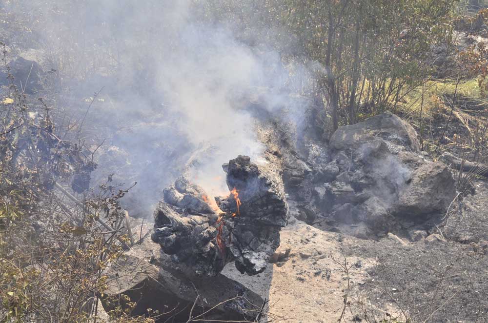
- A tree trunk sits beside the road still aflame due to the Rail Ridge Fire on Sept. 4, 2024.
DAYVILLE — Favorable weather conditions led to reduced fire activity as firefighters continue containment efforts on the Rail Ridge Fire, the fire’s managers said in a Sept. 12 update.
Trending
Fire managers were unable to conduct infrared imaging prior to today’s update, leaving the fire scorching the South Fork John Day River drainage at the same 161,675 acres reported yesterday. Fire managers said they expected modest fire growth from yesterday to today due to improved weather conditions.
Once again the number of firefighters battling the blaze ticked up slightly from the 1,029 firefighters on the scene to 1,053 reported today. Containment of the conflagration also held steady at 12%.
Of the five megafires (blazes of 100,000 acres or more) currently burning in Oregon, three are burning partly in Grant County. In addition to the Rail Ridge Fire, they are the Falls Fire (152,000 acres) and the Battle Mountain Complex (183,000 acres).
Trending
The state’s other two megafires — the 294,000-acre Durkee Fire and the 137,000-acre Lone Rock Fire — are in neighboring counties.
California Complex Interagency Incident Management Team 10 took command of the fire at 7 a.m. on Friday, Sept. 6.
Resources continue to prioritize efforts to protect local communities, structures and land. Today, the focus is on boxing in the northwest edge of the fire by completing control line to ensure the fire doesn’t flank out and impact nearby communities.
In the Battle Creek area, heavy equipment will continue to address access issues, while considering long-term impacts on road conditions.
In the Guyon Basin, resources continue to tie control lines together across the South Fork area, working to keep the area behind Dayville secure. Oregon State Fire Marshal (OSFM) task forces will extend mop up around structures in this area, working down to the South Fork Road. Along Fields Creek/FSR 21, road prep work continues, and firefighters will be looking for opportunities to engage directly with the fire.
Multiple air resources will be available to assist with suppression efforts throughout the day, weather permitting.
In the Morgan Mountain area, the focus remains on completing containment lines around the slop fire. Within the fire perimeter, there is an unburned island near Sugarloaf Mountain that crews will be assessing for potential firing operations.
On the south and southwest portions of the fire, nominal fire behavior has been observed and crews will continue to complete mop up and hold control lines, working towards Wolf Mountain and tying line into road systems out to the west. OSFM resources have wrapped up structural triage and prep on the south end and will be assisting wildland partners with mop up along control lines.
Wildland crews will be engaged in mop up throughout the fire area, focusing on heat still holding in the junipers. These trees hold considerable heat in their root systems and make them susceptible to torching. By addressing these types of hazards, the fire line becomes more secure and long-term stability on the incident is improved.
Overnight, resources focused on maintaining the progress achieved during day shift. The fire area received wetting rains until about midnight, resulting in minimal fire behavior that did not challenge any containment lines.
Crews monitored, patrolled and held established control lines and worked to keep key access roads open against snags and hazard debris. This has been especially challenging for crews working along FSR 2150, which provides vital access to critical communications infrastructure at Aldrich Lookout. Battle Creek Road had to be shut down due to heavy rainfall during the night.
Yesterday, favorable weather contributed to reduced fire activity, and minimal growth was noted. The Dayville, Morgan Mountain, and Battle Creek areas were prioritized. Near Dayville, OSFM crews mopped 100’ out from structures that were near the fire line.
Crews took advantage of cooler temperatures to secure the area behind the community of Dayville, tying together control lines and mopping up, while OSFM crews ensured areas around structures were cool and secure.
At the slop over near Morgan Mountain, containment lines were extended, and very little fire behavior was observed. As wildland resources installed line and engaged with the fire there, OSFM task forces provided structure protection to homes in the area and assisted with monitoring established line.
The area is now about 85% lined.
Near Battle Creek, heavy equipment was used to improve access points for crews to reach fire within the wilderness area that has been slowly crawling in the lighter fuels. Resources in this area have been hampered by access and have been using both direct and indirect tactics.
On the southern edge of the fire, crews remained in patrol mode and conducted mop up operations. Due to multiple days of minimal fire growth during the night, several hand crews are being reallocated to day shift to support incident objectives.
With the reduction in fire activity and the significant preparation work that has been completed, OSFM is able to downsize the number of task forces assigned to the Rail Ridge Fire.
Cooperative efforts of resources have contributed to significant progress and fire activity has been minimized in the vicinity of structures. Task forces from Washington state and Yamhill County will return to their home agencies today, leaving six OSFM task forces (30 apparatus), assigned to the fire.
These remaining crews will continue to provide around the clock structural protection, with a heavy presence in Dayville, South Fork Road, Fields Creek, and Morgan Mountain areas.
Showers continued into the night, providing wetting rains over the fire. Cool conditions will continue today, with seasonably cool and dry conditions expected across the fire through the coming weekend.
A community meeting will be held tonight at the Paulina Community Center located at 70299 Paulina City Road.
The Forest Service and BLM have implemented partial closures due to the Rail Ridge Fire and Crazy Creek Fire, for all uses. For more details and closure maps, visit the Ochoco National Forest, Malheur National Forest, and BLM web pages.
Shelters are available to evacuees. For up-to-date evacuation information, please visit:
Crook County: Crook County Emergency Management website and Crook County Sheriff’s Office Facebook page.
Wheeler County: Wheeler County Sheriff’s Office Facebook page .
Grant County: Grant County Emergency Management Facebook page
Cause: Lightning
Acreage: 161,675
Containment: 12%
Crews: 11
Engines: 130
Dozers: 35
Aircraft: available as needed/air is clear
Total resources: 1053
Marketplace


-
eEdition

-

-
