Rail Ridge Fire now 25% contained
Published 2:00 pm Friday, September 13, 2024
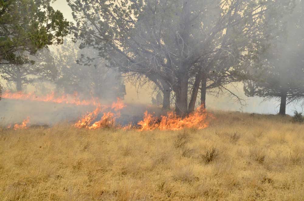
- The head of the Rail Ridge Fire on Sept. 4, 2024. (Justin Davis/Blue Mountain Eagle)
DAYVILLE — The Rail Ridge Fire showed no growth for a third straight day as containment of the conflagration rose significantly while firefighters continue to make progress in battling the blaze, fire mangers said in a Sept. 13 update.
Trending
The fire, currently burning in the South Fork John Day River drainage remains stable at 167,675 acres while containment has more than doubled to 25% from 12% reported yesterday. The number of firefighters battling the blaze continues to rise, sitting at 1,189 compared to yesterday’s count of 1,053.
Of the five megafires (blazes of 100,000 acres or more) currently burning in Oregon, three are burning partly in Grant County. In addition to the Rail Ridge Fire, they are the Falls Fire (152,000 acres) and the Battle Mountain Complex (183,000 acres).
The state’s other two megafires — the 294,000-acre Durkee Fire and the 137,000-acre Lone Rock Fire — are in neighboring counties.
Trending
California Complex Interagency Incident Management Team 10 took command of the fire at 7 a.m. on Friday, Sept. 6.
Cooperative efforts have contributed to significant progress on the fire and containment continues to increase in the vicinity of structures, prompting downgrades to evacuation levels in Dayville. With the reduction in fire activity and correlating diminishing threat to structures, Oregon State Fire Marshal (OSFM) will be downsizing the number of structural task forces assigned to the Rail Ridge Fire over the next couple of days.
Released crews will return to their home agencies, returning valuable resources to their communities. Remaining crews will continue to provide around the clock structural protection, maintaining a presence in Dayville, South Fork Road, Fields Creek, and Morgan Mountain areas.
Firefighters have worked to maximize the opportunity recent rains and cloudy, cooler weather have provided to bolster protections around structures in the impacted area of the Rail Ridge Fire as well as take an increased direct attack approach where conditions allow. OSFM task forces remain engaged in the communities at risk and have worked to cold trail, ensuring no heat remains, and mop up as much as 150 feet from affected structures as well as aiding in mop up efforts throughout the area.
With reduced fire behavior, crews will work as close to the fire’s edge as possible to minimize any new growth south of Dayville in Guyon Basin as well as improve existing lines and continue alternate line construction to the east toward Aldrich Lookout.
Along the east edge of the fire, firefighters have control lines around Tuesday’s slop over near Morgan Mountain and will be mopping up any lingering hot spots and improving line. Crews are working to address unburned islands of vegetation near Sugarloaf Mountain and strengthen lines west toward Sage Hen Flat and O’Henry Reservoir.
Crews will continue to monitor and patrol lines from Suplee north to the Black Canyon Wilderness Area. From there, firefighters are improving roads around Wolf Mountain to contain the fire’s northwest edge.
Overnight, crews remained vigilant despite reduced fire behavior and patrolled the fire’s edge as well as ensuring the safety of impacted residences throughout the area.
Recent rains have greatly reduced fire behavior but heavy fuels – logs, trees, larger stumps, etc. – still hold significant heat and could show smoke as conditions move to a cooler, drier trend for the next several days. Winds will be generally light and terrain driven with gusts up to 10 mph.
A community meeting is scheduled for 5 p.m. tonight at the Izee schoolhouse located at 45477 Izee-Paulina Lane.
The U.S. Forest Service and Bureau of Land Management have implemented partial closures because of the Rail Ridge and Crazy Creek fires, for all uses. For more details and closure maps, visit the Ochoco National Forest, Malheur National Forest, and BLM web pages.
Shelters are available to evacuees. For up-to-date evacuation information, please visit:
Grant County: Evacuation levels have been downgraded for some areas around Dayville. For more information, visit the Grant County Emergency Management Facebook page.
Crook County: Crook County Emergency Management website and Crook County Sheriff’s Office Facebook page.
Wheeler County: Visit the Wheeler County Sheriff’s Office Facebook page.
Marketplace


-
eEdition

-

-
