Falls Fire now 87% contained; Sand Fire at 85%; Telephone Fire 64%
Published 12:52 pm Monday, August 12, 2024
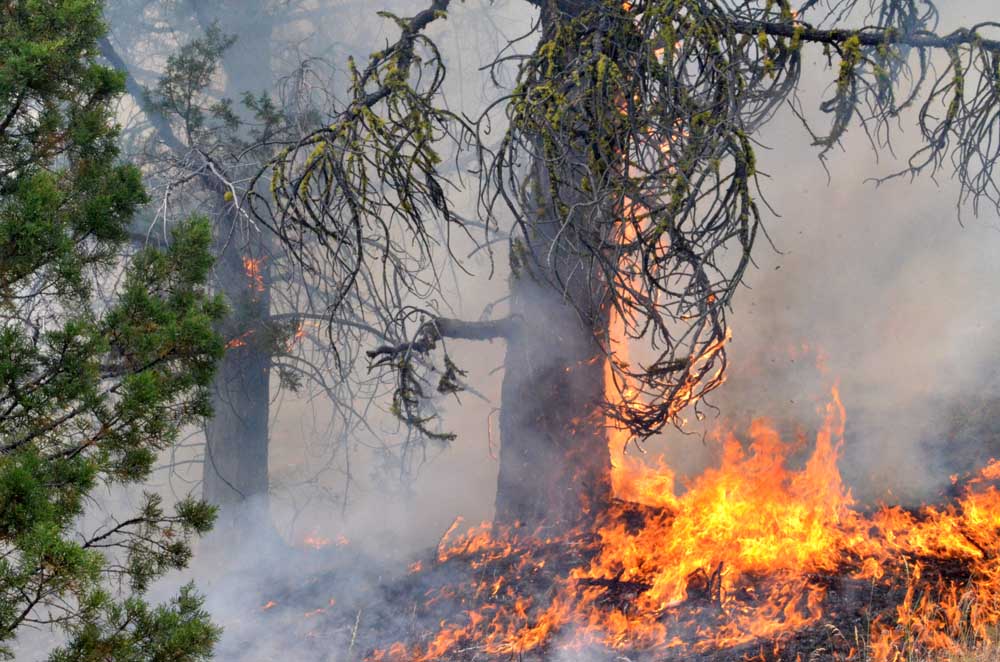
- Flames claim a tree on the Falls Fire's leading edge on July 16, 2024.
BURNS — A community meeting to discuss resources for post-fire recovery was scheduled for Tuesday as firefighters significantly extended containment on the Falls and Sand Mountain fires and held the line on the Telephone Fire, fire managers reported in an update on Monday, Aug. 12.
Trending
The Falls Fire, burning 13 miles northwest of Burns, is now an estimated 151,000 acres with containment at 87%, up from 77% on Saturday. The Sand Mountain Fire, a 7,600-acre blaze 17 miles southwest of Seneca, is now 85% contained, up from 52% on Saturday. And the Telephone Fire, burning 12 miles northeast of Burns, is estimated at 54,000 acres and 64% containment, up from 61% on Saturday.
A total of 1,135 personnel are assigned to battle all three fires.
Resources assigned to the fire zone include one Type 1 helicopter, 30 hand crews, 48 engines, 14 bulldozers, 31 water tenders, one masticator and 12 skidgines.
Trending
A post-fire recovery meeting, hosted by the Oregon State University Extension Service, will be held at 7 p.m. Tuesday at the Harney County Chamber of Commerce, 484 N. Broadway Ave., Burns.
Officials will provide information about resources available for residents, landowners, livestock and agricultural operations impacted by the Falls and Telephone fires. This meeting will be recorded and shared on the Falls and Telephone Fires Facebook page.
Fire managers laid out the following priorities for Monday:
1) Initial Attack (IA) is the highest priority to keep all new fires as small as possible.
2) West side of the Telephone Fire/King Mountain area.
3) Northeast portion of the Falls Fire near Myrtle Creek.
Fire summaries
Telephone Fire: On Sunday, firefighters continued to focus on the northwest corner of the fire, deepening the containment in the Gobbler’s Knob area and patrolled the eastern perimeter. Smoke from unburned fuel in a green pocket near East Cow Creek was visible from the roadway but did not impact containment.
On Monday, firefighters will continue securing the fire edge along the 2820 Road east of Coffeepot Creek and working aggressively to keep fire west of the 28 Road. Additionally, ranchers, firefighters and cooperators will be working together to drive cattle south along the 28 Road to safer, unburned areas for grazing.
Other portions of the fire will continue to be monitored and patrolled.
Falls/Sand Mountain Fires: On Sunday, firefighters monitored and patrolled the south and west portions of the fire near Sand Mountain and Gilbert Ridge. Efforts were focused on preventing the fire from impacting private property, rangelands and livestock.
Monday, crews will continue to contain fire near the 31 Road northeast of Crane Flats. Removal of hazardous trees called snags in the northeast portion of the fire continues.
Snags are dead, standing trees in the fire area without leaves or needles in the crowns. These trees are a significant hazard to wildland firefighters because they have lower fuel moistures. These trees burn more readily and topple easily in high winds. With the expected windy conditions later Monday, removing them is an important task.
Crews will also be strengthening containment and monitoring earlier fire spread near Myrtle Creek. As containment increases and more of the fire is under patrol status, conditions remain challenging. Crews are staying vigilant, working to strengthen lines and secure problem areas.
Weather: Overnight, some portions of the fire area saw good relative humidity recoveries. Monday’s elevated risk of thunderstorms could lead to increased weather instability. The atmosphere may be unsettled with rapid changes, and storms may bring lightning and gusty outflow winds up to 45mph. In the evening hours chances of thunderstorms could rise to 30%. Some portions of the area might see wetting rains. Looking ahead, temperatures are expected to trend cooler throughout the week.
Evacuations: There are no changes to the evacuation orders for Grant and Harney Counties. For the most accurate evacuation information, visit the Harney County Sheriff’s evacuation map: https://bit.ly/FallsFireEvac, or the Grant County Emergency Management Facebook page: https://www.facebook.com/profile.php?id=100068819321423
Closures: A closure is in effect for portions of the Malheur National Forest west of Highway 395, north of Mt. Vernon and south of Long Creek, in the Fox Valley area, including all roads, trails, and camping. A closure map is available on the Malheur National Forest website (https://www.fs.usda.gov/detail/malheur/news-events/?cid=FSEPRD1198892) and in local U.S. Forest Service offices.
Investigation: The U.S. Forest Service is seeking the public’s assistance with any information pertinent to the start of the Falls Fire on the Malheur National Forest. Submit any relevant information to SM.FS.R6TipHotLine@usda.gov.
Temporary Flight Restriction (TFR): TFRs in the area have been changing; pilots should check the latest information on the Federal Aviation Administration TFR website prior to flying: https://tfr.faa.gov/tfr_map_ims/html/index.html
More information
Facebook: https://www.facebook.com/p/Falls-Fire-2024-61562126623985/
Falls Fire InciWeb: https://inciweb.wildfire.gov/incident-information/ormaf-falls-fire
Telephone Fire InciWeb: https://inciweb.wildfire.gov/incident-information/ormaf-telephone-fire
Fire Information Line: 541-208-4370, staffed 8 a.m. to 8 p.m.
Email: 2024.Falls@firenet.gov
Harney County Non-emergency Evacuation Questions: 541-589-5579
Air Quality Questions: 541-573-2271. Air quality information, searchable by ZIP code: https://fire.airnow.gov/
Smoke Outlooks: https://outlooks.airfire.org/outlook
Size: 53,989
Start Date: July 22, 2024
Location: 12 miles NE of Burns, OR
Containment: 64%
Cause: Lightning/Natural
Total Personnel Across All Fires: 1,135
Size: 150,941
Start Date: July 10, 2024
Location: 13 Miles NW of Burns, OR
Containment: 87%
Cause: Human-caused, under investigation
Structures Triaged: Residences: 386 / Commercial: 119 / Outbuildings: 760
Total Personnel Across All Fires: 1,135
Size: 7,582
Start Date: July 25, 2024
Location: 17 miles SW of Seneca, OR
Containment: 85%
Cause: Lightning/Natural
Marketplace


-
eEdition

-

-
