National forest lands near Falls Fire closed
Published 1:14 pm Thursday, August 1, 2024
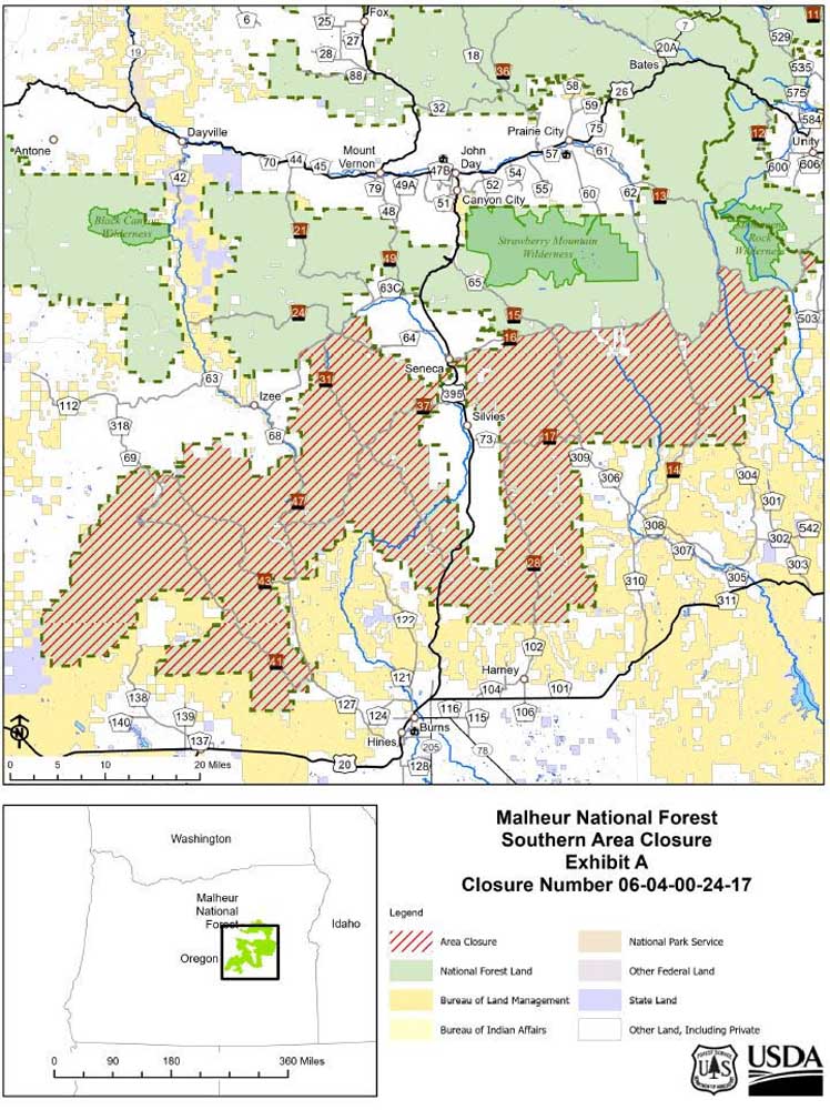
- falls fire closure map 240801
JOHN DAY — A portion of the Malheur National Forest near the Falls Fire has been closed due to wildfire activity, forest officials announced.
Trending
The Malheur National Forest has issued a new area closure to protect public health and safety, officials said.
This closure will be effective starting Thursday, Aug. 1, and continue until further notice.
This Forest Order rescinds and replaces the previous Falls Area Fire Closure #3 and the Temporary Malheur Forest Closure Order.
Trending
The closure includes the following areas:
• South of Grant County Road 63 (Izee-Paulina Highway) following the National Forest boundary to Highway 395 south of Seneca.
• Highway 395 south of Seneca following the National Forest Boundary to Forest Service Road 1600 to the eastern boarder of the Malheur National Forest. All National Forest lands to the south of Forest Service Road 1600.
• The entirety of the Emigrant Creek Ranger District on the Malheur National Forest.
For more information on the fires visit: https://inciweb.wildfire.gov/
Marketplace


-
eEdition

-

-
